
| Affiliate disclosure This article may contain affiliate links. If you buy or sign up through an eligible link, HiddenGemTrips may earn a commission at no extra cost to you. Recommendations are included for practical relevance, not because a mountain bribed us. |
The best Guatemala Highlands Guide is not a race between the brightest textile stall and the loudest volcano. It is a lesson in timing. A town can feel ordinary on Wednesday and become a regional trading floor on Thursday. A trail can look clear from a rooftop in Antigua and close hours later because wind, ash, rain, or official restrictions changed. The highlands reward travelers who treat schedules as living information rather than decorative details.
This route connects seven stops across central and western Guatemala: Antigua, Chichicastenango, Sololá and Lake Atitlán, San Francisco El Alto, Quetzaltenango, Zunil and Almolonga, and Todos Santos Cuchumatán. Together they reveal a highland system shaped by K’iche’, Kaqchikel, Tz’utujil, Mam, and other Maya communities; colonial history; working agricultural valleys; weekly commerce; steep roads; and active volcanic landscapes.
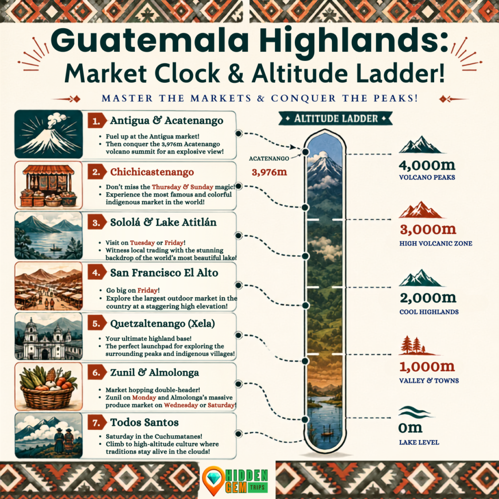
The guide is deliberately different from a greatest-hits itinerary. It uses two practical tools. The first is a market clock: the week matters because the largest trading days draw vendors and buyers from surrounding communities. The second is an altitude ladder: your body needs a gentler progression before a serious summit. That mindset fits the broader method in our guide to finding hidden destinations without pretending they are empty and our slow-travel argument for doing fewer things with more attention.
You can complete a selective version in eight days, but ten to twelve days is better. The longer plan creates room for market days, weather changes, volcanic updates, and recovery after long transfers. It also makes the trip less extractive. You stay longer, spend across more local businesses, and stop treating every community as a two-hour photo assignment.
Why This Guatemala Highlands Guide Uses a Market Clock and Altitude Ladder
Google Maps sees distance. The Guatemalan highlands add market congestion, roadworks, mountain fog, landslides in wet periods, road demonstrations, vehicle changes, and the ancient travel tradition known as “that looked much faster on the screen.” A realistic route therefore begins with flexible days and verified local information.
Before adding a remote town, ask the same questions covered in our framework for deciding whether a so-called secret destination is actually ready for visitors: Is public access clear? Is the road dependable enough for your transport? Are local guides available? Can the community absorb visitors without being reduced to a costume backdrop? Is there an exit plan if weather or security conditions change?
The altitude ladder matters just as much. Antigua sits at a moderate highland elevation, Lake Atitlán allows lower sleeping options near the water, Xela is higher and colder, while major volcano summits approach 4,000 meters. The CDC’s high-altitude guidance explains that at roughly 3,050 meters, inspired oxygen pressure is about 69 percent of the sea-level value. Fitness does not create immunity to altitude illness. A marathon runner can still become the saddest person at base camp.
A useful sequence is: arrive and sleep in Antigua; spend several nights around Lake Atitlán; move to Xela; then consider higher or more remote terrain. If your schedule is short, choose either a demanding volcano trek or the far-western Cuchumatanes extension—not both. The article on building a deep seven-day trip without stacking every attraction is useful here, while the two-base itinerary method can simplify an eight-day version using Antigua and Lake Atitlán or Antigua and Xela as anchors.
Guatemala Highlands Quick Planning Table
| Stop | Usual Market Peak* | Elevation Context | Best For | Suggested Time |
| 1. Antigua Guatemala | Daily market; busiest Mon/Thu/Sat | ~1,500 m band | UNESCO city, food market, Acatenango/Fuego decision | 2–3 nights |
| 2. Chichicastenango | Thu/Sun main days | ~2,000 m band | Regional market, Santo Tomás, cemetery, craft context | 1 night or day trip |
| 3. Sololá + Lake Atitlán | Tue/Fri in Sololá | Lake ~1,560 m; Sololá higher | Local market, lake villages, optional guided volcano hike | 3 nights |
| 4. San Francisco El Alto | Friday | ~2,600 m band | Large working market, livestock/household trade, rooftop views | Half day from Xela |
| 5. Quetzaltenango (Xela) | Markets active daily | ~2,330 m | Urban highland base, Santa María/Santiaguito decisions | 3 nights |
| 6. Zunil + Almolonga | Zunil Mon; Almolonga often Wed/Sat | ~2,000–2,400 m | Produce valleys, hot springs, village commerce | Day trip from Xela |
| 7. Todos Santos Cuchumatán | Saturday | ~2,700 m band | Mam town, Cuchumatanes walking, community market | 2 nights |
*Market schedules, road access, operating hours, and trail permissions can change. Check nonrefundable plans with accommodation hosts, local tourism offices, transport providers and official authorities.
Before You Go: Four Decisions That Count More than a Perfect Map
1. Consult Current Safety Advice by Exact Route
At the time of writing in July 2026, the U.S. State Department’s Guatemala advisory recommends reconsidering travel because of crime and terrorism and identifies areas with higher risk. The UK Foreign, Commonwealth & Development Office advice also distinguishes between regions and advises against all but essential travel to parts of the country. These notices can change. Read the regional details—not just the headline level—then compare them with local updates close to departure.
Use daytime transport where practical, avoid flashing expensive equipment in crowded terminals and markets, and ask your accommodation which transfer points are currently sensible. Solo travelers should also adapt the layered checks in our under-the-radar solo female travel safety map: route sharing, arrival windows, independent transport verification, and a backup contact are more valuable than vague reassurance.
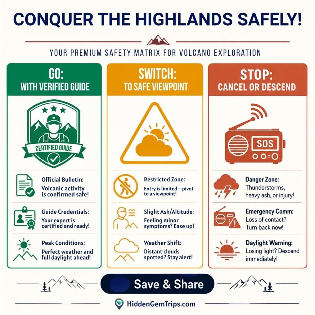
2. Treat Volcano Status as a Same-Day Variable
Guatemala’s official volcanology agency, INSIVUMEH, says it performs real-time multiparameter monitoring of six active volcanoes: Pacaya, Fuego, Santiaguito, Atitlán, Agua, and Tacaná. It reports that Santiaguito has the country’s most extensive monitoring network, with 13 multiparameter stations. That is a useful reality check: a volcano is a monitored hazard system, not a guaranteed sunrise product. Check INSIVUMEH’s special volcanology bulletins before any hike or viewpoint visit.
CONRED’s official volcano-ascent recommendations emphasize advance planning, weather and activity checks, suitable clothing, water, basic first aid, communication, and compliance with local instructions. Choose registered or well-established guides, ask how they respond to closures, and reject any operator who markets restricted proximity as an “exclusive” experience. Exclusive is a weird synonym for evacuating downhill.
3. Build a Budget for Friction, Not Just Prices
Guatemala can be good value, but the highlands create hidden costs: private transfers when public connections fail, an extra night to align with market day, warm gear rental for Acatenango, guide fees, luggage storage, cash withdrawal fees, weather delays, and a second transport leg when the first bus ends somewhere creatively described as “nearby.” Use our guide to the remote-trip costs travelers often forget and the practical budget hacks for finding hidden gems without false economy.
Mid-range comfort can also be strategic. A warm room in Xela, a reputable volcano operator, and a private transfer for a difficult connection may protect the entire itinerary. That is the useful version of affordable opulence in less-famous destinations: spend on sleep, safety, and time—not on decorative upgrades that leave you exhausted.
4. Confirm Health Needs Before Leaving
Consult a qualified travel-health professional early, especially if you plan high-altitude hiking or have heart, lung, pregnancy, mobility, or medication concerns. The CDC Guatemala traveler page provides current destination-specific health notices and vaccination guidance. Bring enough prescription medication, protect wounds and skin, use safe water and food habits, and do not treat persistent severe headache, confusion, unusual breathlessness, or coordination problems as character-building.
Guatemala Highlands Guide: 7 Market and Volcano Stops
1. Antigua Guatemala: Start with the Market, Then Earn the Volcano
Antigua is the logical first base because it combines transport access, accommodation depth, walkable streets, and a moderate-altitude landing. It also provides context before the more demanding western route. The city was inscribed on the World Heritage List in 1979; the UNESCO description of Antigua Guatemala highlights its historic role as the region’s cultural, economic, religious, political, and educational center before the capital moved.
Do not reduce Antigua to pastel façades and rooftop volcano photos. Begin at the municipal market west of the center. It operates daily, while local reporting identifies Monday, Thursday, and Saturday as the busiest traditional market days. Walk the produce, prepared-food, household, and transport-facing sections before browsing artisan stalls. This sequence changes the experience: you see a city feeding itself, not merely selling Guatemala-colored objects to visitors.
Ask permission before close portraits. Learn the difference between a handwoven huipil, machine embroidery, secondhand ceremonial clothing, and souvenir textiles made for quick turnover. A fair purchase is not only about the final number; it is also about whether you understand what you are buying and whether the seller controls the story. This is the same local-first shift that makes our Colombia coffee-town route feel like a lived region rather than a pastel checklist.
Antigua is also where travelers decide whether Acatenango belongs in the trip. The standard overnight route is physically demanding, cold, dusty or muddy depending on conditions, and high enough to trigger altitude symptoms. The reward can be a dramatic view toward Fuego, but visibility and access are never guaranteed. Spend at least two nights in the region before the climb, choose an operator with clear cancellation and emergency procedures, and confirm official bulletins the day before and the morning of departure.
You do not need to approach Fuego to have a meaningful experience. In fact, the safer and more responsible goal is an authorized Acatenango route with distant observation when conditions allow. Skip any unofficial extension into restricted terrain. A guide’s confidence is not a force field.
Plan two or three nights: one for arrival and the market, one for a city or village day, and one or two for the volcano if selected. If you arrived after a long flight, read our guide to surviving the long-haul journey before making major decisions at altitude. Jet lag plus a near-4,000-meter summit is an aggressively bad collaboration.
2. Chichicastenango: Visit the Trading Town, Not Just the Souvenir Aisle
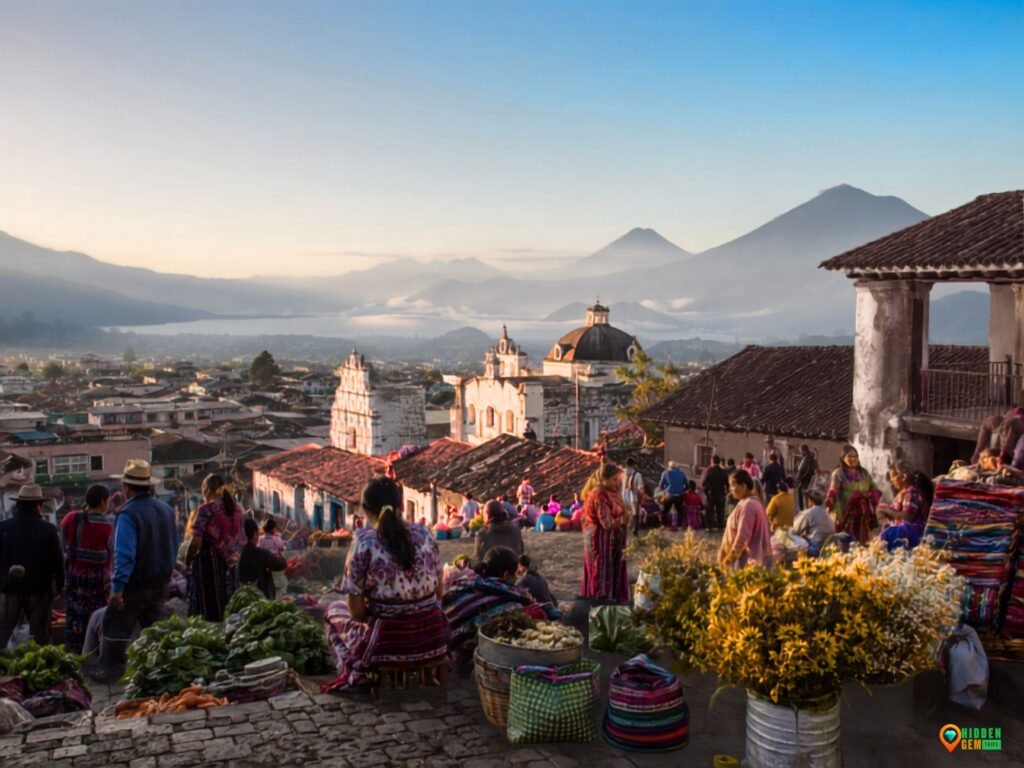
Chichicastenango is famous enough to be called touristy and important enough to resist that simplification. Its main market days are traditionally Thursday and Sunday, when streets around Santo Tomás and El Calvario fill with produce, flowers, candles, incense, tools, textiles, masks, household goods, prepared food, and visitors trying not to lose each other. The market serves residents and regional traders; the tourism layer is visible but not the whole organism.
The best strategy is to sleep in town the night before. Arrive in the afternoon, walk the center without chasing photographs, and start early the next morning. You will see setup, wholesale movement, food preparation, and commuters before day-trip groups compress into the main lanes. Early arrival also gives you time to step away when the central streets become overstimulating.
Use the official INGUAT tourist office in Chichicastenango to confirm current opening patterns, local guidance, festival impacts, and transport information. Market days can be altered by holidays, road conditions, security events, and local decisions. Any article that treats a weekly schedule as a law of physics is cosplaying as a timetable.
At Santo Tomás, visitors encounter overlapping Maya and Catholic religious practices. Observe quietly, do not block worshippers, and never climb onto active ceremonial spaces for a photograph. Smoke, candles, flowers, processions, and prayer are not “content elements.” They are someone else’s religious life. The nearby cemetery and Pascual Abaj area also require restraint and, ideally, local interpretation.
When buying textiles, ask where the piece was made, whether it is new or used, what technique was used, and whether the maker is known. Bargaining may be expected, but grinding a seller down over a small amount is not a cultural achievement. It is just being exhausting in two languages.
Chichicastenango can be a day trip from Antigua or Lake Atitlán, but an overnight stay creates a fuller article-worthy experience. It also supports local accommodation and food businesses instead of funneling nearly all spending into a shuttle and one souvenir transaction. This slower community context echoes our route through Tana Toraja’s culture roads, where timing and respectful access matter more than collecting sights.
3. Sololá and Lake Atitlán: Use the Market Above the Lake to Read the Region
Many travelers reach Lake Atitlán, board a boat, visit three villages, photograph three volcanoes, and leave with no understanding of how the department moves. Sololá corrects that. Perched above the lake and connected to surrounding communities, its major market days are usually Tuesday and Friday. The market is less engineered around international visitors than Chichicastenango, which makes it valuable—and makes discreet behavior more important.
Come early from Panajachel or stay nearby. Watch how produce, clothing, tools, food, and transport intersect. Men and women may wear town- or community-specific clothing, but do not turn visual difference into a scavenger hunt. Ask before portraits, keep cameras away from children unless a parent clearly agrees, and avoid publishing precise personal details about vendors.
After the market, descend to the lake and choose one or two villages based on interest rather than boat efficiency. San Juan La Laguna can support a deeper visit focused on weaving, natural dyes, murals, coffee, and women-led enterprises. Santiago Atitlán offers Tz’utujil history and religious complexity. Panajachel is the practical transport hub. San Marcos is oriented more toward wellness and foreign visitors. San Pedro is a base for nightlife, language study, and the guided San Pedro Volcano hike.
The lake’s volcanoes shape the view, but every hike needs a current local safety check. Trail security and access history vary, guides may be required or strongly advisable, and weather can erase views by late morning. Select an authorized local guide, start early, and do not assume a route is safe because recent reviews sound cheerful. Reviews are snapshots; mountains are live systems.
Lake Atitlán is a good place to recover after Acatenango or to acclimatize before Xela. Sleep near lake level, take a higher day trip to Sololá, and return lower. That “climb high, sleep lower” pattern resembles one of the sensible strategies described in high-altitude guidance. It also turns the itinerary into a sequence instead of a punishment.
Allow three nights. One day for Sololá, one for a village pair, and one flexible lake day. Use boats conservatively in rough weather, carry small cash, and leave buffer time before onward transport. Travelers who enjoy routes built around water and highland communities may also appreciate our Northern Laos river-and-mountain guide, but Atitlán requires its own vocabulary: volcanic basin, Maya towns, working transport, and a tourism economy that can shift sharply from one shore to another.
4. San Francisco El Alto: A Friday Market Where the Town Becomes the Map
On Friday, San Francisco El Alto becomes one of the most intense market experiences in the western highlands. Streets, plazas, slopes, and rooftop areas fill with textiles, produce, livestock, tools, plastic goods, clothing, food, and household trade. This is not a curated craft promenade. It is regional commerce with elbows.
The town sits at a higher, cooler elevation than the lake corridor, so it also functions as an altitude step before Xela-area hikes. Start early from Quetzaltenango, carry only what you need, and use a cross-body bag or concealed pouch in the densest sections. Crowded markets are not automatically dangerous, but they are ideal environments for distraction and petty theft.
Do not enter livestock areas assuming they are a petting zoo. Keep distance, follow local movement, and avoid flash photography. The most useful visual story may be the flow of trade: bundles arriving, buyers comparing practical goods, food sellers serving workers, and entire streets temporarily changing function. A market is infrastructure.
From higher points, the geography of the town becomes clearer, but ask before stepping onto private rooftops or commercial buildings. A paid local guide can help interpret product zones, language, clothing, and transport patterns while reducing accidental intrusion. Guides are especially useful when your Spanish is limited or when you want to photograph responsibly.
Treat San Francisco El Alto as a half-day experience, then return to Xela for a quieter afternoon. Do not schedule Santa María the same day. Market sensory load plus a steep overnight or predawn hike is not bold itinerary design; it is your nervous system filing a complaint.
5. Quetzaltenango: Use Xela as the Working Base for Volcano Decisions
Quetzaltenango—usually called Xela—is the strongest multi-night base in the western highlands. It has language schools, markets, cafés, bakeries, transport connections, local tour operators, and enough ordinary city life to prevent the trip from becoming a chain of staged attractions. La Democracia and Minerva market districts provide daily commercial texture, while the historic center offers an evening reset.
Xela is also where travelers confront the Santa María and Santiaguito question. Santa María is a major high-altitude climb; Santiaguito is an active volcanic complex whose explosions, ash, rockfalls, pyroclastic activity, and rain-season lahars require serious respect. INSIVUMEH identifies Santiaguito as especially hazardous and maintains extensive monitoring. Do not attempt restricted approaches or copy social-media routes that move toward the active dome complex.
The safer editorial approach is to present three choices. Choice one: no summit—use authorized viewpoints and local interpretation. Choice two: a guided Santa María ascent only when official conditions, weather, fitness, daylight, and route security align. Choice three: skip the volcano and visit Chicabal or another permitted highland landscape with a reputable guide, recognizing that sacred places also have rules and community meaning.
Spend a full day in Xela before deciding. Walk the central market areas, confirm current guidance with a reputable operator, check official bulletins, and assess how your body feels at the city’s elevation. A headache after arrival is not an invitation to “push through” before dawn. It is data.
Xela also supports better route design because you can separate adventure from recovery. Day one: city and market. Day two: guided highland activity. Day three: Zunil and Almolonga or a rest day. This mirrors the modular logic in our Garut highlands route, where weather and volcanic access shape the day without copying its quiet-escape angle.
Plan at least three nights. Choose accommodation with hot water, warm bedding, luggage storage, and reliable early transport coordination. Glamorous? Not especially. Useful when you return cold and dusty? Deeply.
6. Zunil and Almolonga: See the Agricultural Volcano Landscape at Ground Level
Zunil and Almolonga are close enough to Xela for a day trip but different enough to deserve separate attention. Zunil’s main market day is traditionally Monday, while Almolonga’s produce market is often most active on Wednesday and Saturday. Because weekly patterns can shift, ask your Xela accommodation or guide to confirm the current peak before setting out.
This stop reveals the agricultural side of volcanic terrain. Fertile valleys, steep slopes, irrigation, greenhouses, trucks, wholesalers, and market labor connect the landscape to urban food systems. Almolonga is known for intensive vegetable production, but visitors should resist miracle-soil stories that erase farming knowledge, water, inputs, labor, land pressures, and distribution networks. Giant vegetables make cute headlines; agricultural reality is more complicated.
In Zunil, the market, church, local religious practices, textile cooperatives, and the route toward Fuentes Georginas can be combined carefully. A local guide is valuable for cultural interpretation and for navigating what is appropriate to visit. Ask before photographing shrines, ceremonies, or the local representation of San Simón/Maximón. The fact that a place is described online does not make every ritual publicly available.
Fuentes Georginas offers a warm-water contrast to cold Xela mornings, but access roads and opening conditions can change. Go in daylight, confirm transport both ways, and avoid relying on a driver magically appearing after sunset. Mountain hot springs are excellent until the logistics become a low-budget survival show.
Buy produce, food, or locally made goods without obstructing working areas. If your visit includes a cooperative demonstration, ask how payments reach makers and whether photography is included. This is the same principle used in our Vanuatu outer-islands guide to communities living beside volcanoes: the landscape is dramatic, but local life is not a supporting prop.
7. Todos Santos Cuchumatán: Finish with a Saturday Market Above the Volcano Circuit
Todos Santos Cuchumatán is the route’s deliberate departure from the volcano corridor. Set high in the Cuchumatanes of Huehuetenango, the Mam town replaces active-cone spectacle with limestone and mountain landscapes, distinctive local clothing, Saturday market trade, language, migration history, and a stronger sense of remoteness.
The transfer is long enough to justify two nights. Arrive before Saturday if the market is your priority. Book accommodation and transport in advance, carry cash, and expect colder nights. Road conditions can make the journey slower than distance suggests, particularly in wet weather or during local disruptions. If a day is lost from the itinerary, the extension to the far-west should be dropped (not compressed).
The Saturday market is where people from the surrounding communities come. Observe the practical trade before looking for crafts: vegetables, animals, clothing, yarn, tools, prepared food, and daily necessities tell a richer story than a souvenir-only lens. Traditional clothing is widely worn, but that does not grant blanket permission to photograph. Ask clearly, accept no without negotiation, and avoid telephoto portraits taken from across the street like ethical responsibility has a zoom setting.
Walking in the Cuchumatanes should be arranged with local knowledge. Trails cross community lands, weather changes quickly, and navigation may be unclear. A guide can also explain agriculture, seasonal movement, language, history, and why certain places are sensitive. The goal is not to “discover an untouched village.” Todos Santos has its own history, transnational connections, celebrations, and visitor economy. It was never waiting silently for your arrival.
This stop works best as the conclusion because it slows the route after the visual intensity of markets and volcanoes. It also prevents the guide from implying that Guatemala’s highlands are only defined by erupting peaks. Mountain identity is broader: trade, textiles, farms, roads, language, faith, migration, memory, and weather all shape the journey.
If you enjoy this quieter mountain logic, our Morocco valley guide beyond the obvious city circuit explores a different region with a similar lesson: remoteness should change your pace and behavior, not merely increase the number of dramatic adjectives in your caption.
A Realistic 8-, 10-, or 12-Day Guatemala Highlands Itinerary
| Day | 8-Day Selective | 10-Day Balanced | 12-Day Deep |
| Day 1 | Arrive Antigua; gentle city walk; early sleep | Same | Same |
| Day 2 | Antigua market + heritage context | Antigua market + village/heritage day | Antigua market + village/heritage day |
| Day 3 | Acatenango OR flexible Antigua day | Acatenango overnight OR alternate guided day | Acatenango overnight OR alternate guided day |
| Day 4 | Transfer to Lake Atitlán; recover | Return/transfer to Lake Atitlán | Return/transfer to Lake Atitlán |
| Day 5 | Sololá market if Tue/Fri; lake village | Sololá market + one lake village | Sololá market + one lake village |
| Day 6 | Chichicastenango if Thu/Sun; otherwise village day | Chichicastenango overnight/day trip | Flexible lake day or Chichicastenango overnight |
| Day 7 | Transfer to Xela | Transfer to Xela | Transfer to Xela via San Francisco El Alto if Friday |
| Day 8 | Xela city/market; depart or continue | Xela city + volcano decision | Xela city + market |
| Day 9 | — | Guided highland activity or rest | Guided highland activity or rest |
| Day 10 | — | Zunil/Almolonga; depart | Zunil/Almolonga |
| Day 11 | — | — | Transfer toward Huehuetenango/Todos Santos |
| Day 12 | — | — | Todos Santos Saturday market or guided Cuchumatanes day |
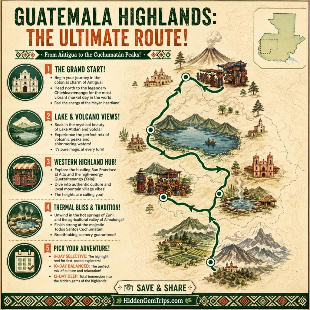
The calendar—not the sequence above—should decide the final order. Anchor the route to the two market days you care about most, then place volcano activities between them. A market can be moved only by changing the day. A viewpoint can often be moved by changing the morning.
Budget and Transport: Where Travelers Usually Underestimate the Route
A highland budget should include four layers: intercity transport, local connections, guide or activity costs, and a disruption reserve. Public buses may be inexpensive, but multiple transfers, crowded luggage conditions, early departures, and unfamiliar terminals can add friction. The shared tourist shuttles make getting around easier, but they run on a limited schedule. Private transfers cost more but can connect awkward market days or remote segments.
- Reserve 10–15 percent of the ground budget for changes: one extra hotel night, a replacement transfer, warm clothing rental, route cancellation, or a safer operator.
- Carry a mix of small quetzal notes. Markets, local buses, small eateries, parking, guides, and rural businesses may not accept cards or may not welcome large bills.
- Confirm what a volcano price includes: transport, park or municipal fees, guide ratio, meals, water, sleeping equipment, warm layers, toilets, emergency communication, and cancellation terms.
- Avoid booking every transfer through the cheapest anonymous message thread. A slightly higher price with a named operator, written pickup details, and a reachable contact can be the best-value purchase of the trip.
What to Pack for Markets, Cold Mornings, and Volcanic Trails
The same bag must handle crowded markets, lake boats, rain, dust, cold summit conditions, and long road days. Pack layers rather than one bulky jacket, keep valuables close to the body, and separate market essentials from trekking equipment. Our remote-road gear guide and light-packing strategy for remote expeditions can help reduce the “one bag for every imaginary emergency” problem.
- Lightweight rain shell and pack cover; wet highland roads can make dust become mud with shocking efficiency.
- Warm mid-layer, hat, and gloves for Xela mornings and volcano departures; verify what your operator provides.
- Shoes with grip that you have already worn. A volcano is a terrible place to begin a relationship with new boots.
- Reusable water bottle plus purification backup appropriate to your health plan and route.
- Small first-aid kit, personal medication, sunscreen, insect protection, and blister care.
- Compact headlamp with spare batteries or a rechargeable power source. For easier packing, travelers can browse lightweight trekking headlamps on Amazon and compare brightness, battery life, weight, and weather resistance before choosing one.
- Offline maps, emergency phrases with translation, copies of documents, written address for the accommodation.
Travel Insurance and Emergency Planning
Insurance is not a permission slip for reckless hiking. Review exclusions related to high-altitude trekking, volcanic activity, motorbike use, emergency evacuation, pre-existing conditions, and destinations covered by travel advisories. Confirm that the policy covers the exact elevation and activities you plan to undertake. Travelers considering flexible international coverage can review SafetyWing Nomad Insurance, then compare its terms, limits, and exclusions with other providers before purchasing.
Save policy documents offline, record local emergency contacts, and share the day’s route with someone not on the hike. INGUAT’s regional structure includes tourist-assistance services; use the official INGUAT regional and tourist-information office directory to locate current help channels. Emergency numbers and service availability should be rechecked before travel.
How to Behave in Highland Markets Without Becoming the Main Problem
- Ask before photographing a person, child, ceremony, or textile demonstration. A smile is not always consent; sometimes it is simply a polite response to a stranger blocking the aisle.
- Learn a few Spanish phrases and accept that some vendors may prefer a Maya language. Communication limits are not an invitation to speak louder.
- Bargain respectfully where it is normal, but do not turn a small difference into a public contest. The economic impact is not equal on both sides.
- Do not handle ceremonial or antique textiles casually. Ask what may be touched, unfolded, tried on, or photographed.
- Keep pathways clear. Markets are workplaces and transport systems, not outdoor studios reserved for composition.
- Buy food, transport, guiding, and everyday services—not only objects. A broader spend supports more people.
- Avoid geotagging fragile ritual locations or private homes. Responsible travel sometimes means leaving a place harder to copy.
Best Time to Visit the Guatemala Highlands
The drier period, commonly from November through April, usually offers more predictable hiking conditions, clearer mornings, and colder nights. The wetter period, often May through October, can bring greener landscapes, afternoon storms, mud, landslide risk, clouded volcano views, and changing road conditions. Climate patterns are not guarantees, and tropical weather enjoys humiliating confident forecasts.
For markets, weekday alignment matters more than season. For volcanoes, visibility and official safety status matter more than a brochure’s “best month.” For major religious or community festivals, accommodation and transport can fill early while photography etiquette becomes even more important. Confirm whether visitors are welcome and what behavior is expected.
A strong compromise is late November to February for cooler, often clearer highland travel, provided you pack for cold nights. March and April can be warmer and busier around Holy Week, especially in Antigua. During the rainy season, keep afternoon plans soft, avoid night driving on unfamiliar mountain roads, and add a spare day.
Conclusion: Let the Week Shape the Route
The Guatemalan highlands do not need another itinerary that tells travelers to “do Chichi, do the lake, do Acatenango, do Xela” as if communities and volcanoes are interchangeable appointments. The stronger journey is built around rhythm: arrive gently, learn how the markets work, gain elevation gradually, verify conditions, and accept that one canceled hike can create space for a better town day.
The seven stops in this Guatemala Highlands Guide are not equal boxes. Antigua is the landing and decision point. Chichicastenango and Sololá reveal different market economies. San Francisco El Alto turns an entire town into regional infrastructure. Xela makes a practical base. Zunil and Almolonga connect volcanic land to food. Todos Santos Cuchumatán widens the story beyond volcanoes.
Choose two market days, one demanding mountain activity at most, and enough nights to recover. Spend locally, ask before photographing, and believe official closures. The trip will contain fewer triumphant checkmarks and more actual understanding. That is a suspiciously good trade.
Frequently Asked Questions
1. How many days do I need for the Guatemala highlands?
Eight days works for Antigua, Lake Atitlán, Chichicastenango, and Xela with selective stops. Ten days is more balanced. Twelve days allows the Todos Santos Cuchumatán extension without compressing transport and market timing.
2. Which market is better: Chichicastenango or Sololá?
Chichicastenango is larger, more famous, more visitor-facing, and easier to arrange as a day trip. Sololá feels more connected to regional everyday trade and is often less oriented toward souvenirs. Visiting both reveals different functions rather than a simple winner.
3. Is the Acatenango hike safe?
No active mountain route is risk-free. Conditions, access, weather, altitude, operator standards, and Fuego activity can change. Use a reputable guide, check INSIVUMEH and CONRED information, allow acclimatization time, and accept cancellation or closure.
4. Can I travel through the highlands by public bus?
Yes, lots of travelers use public buses and minibuses, but you may have to change routes, deal with crowded terminals, have limited control over your luggage and speak Spanish fairly well. Use day-time connections, check where you have to change and think about using shuttles or private transport for tricky bits if you need.
5. Is this a route for solo travelers?
It can be, but solo travelers should use current regional advisories, trusted accommodation, daylight arrivals, route sharing, verified guides, and conservative transport choices. Remote trails and active-volcano zones should not be approached alone.
Travel and Affiliate Disclaimer
This article is for general travel-planning and educational purposes. Market days, transport schedules, prices, road access, security conditions, park rules, weather, volcanic activity, trail restrictions, health guidance, and entry requirements can change without notice. Always verify information with official authorities, local tourism offices, qualified guides, transport providers, accommodation hosts, and current government advisories before travel.
Volcano hiking and high-altitude travel involve serious risks, including altitude illness, falls, exposure, storms, ash, rockfall, pyroclastic activity, lahars, route closures, and limited emergency access. Do not enter restricted areas or rely solely on social media, tour reviews, or this article for safety decisions. Consult a medical professional for personal health advice. Some links may be affiliate links. HiddenGemTrips may receive a commission for purchases/sign-ups made through links in this post, at no additional cost to you. Affiliate relationships do not guarantee that a product, service, insurance policy, or tour is suitable for a particular traveler. Read all terms, exclusions, limits, and cancellation policies independently.