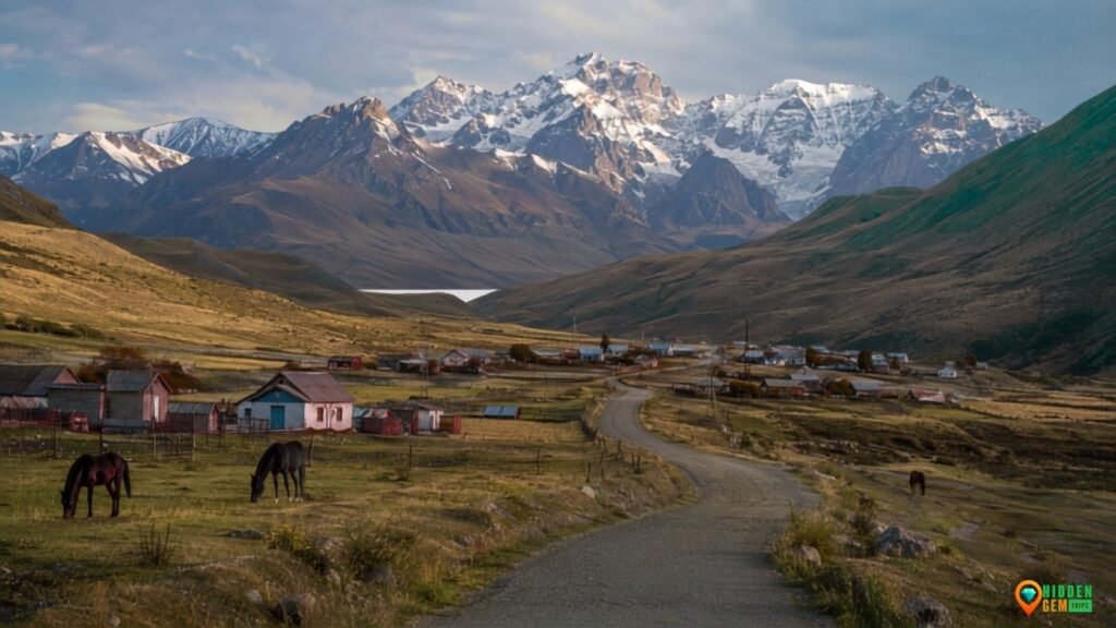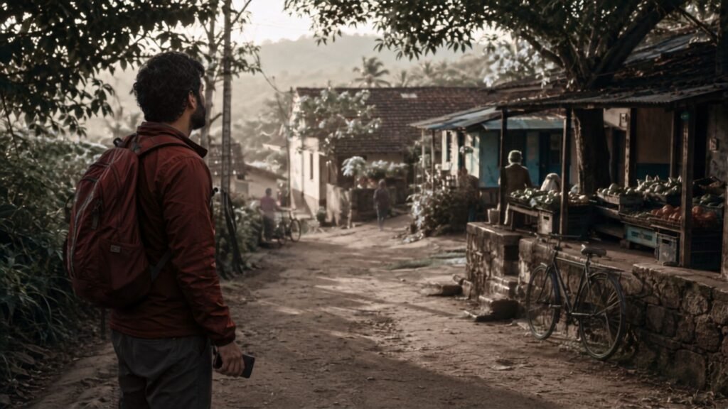

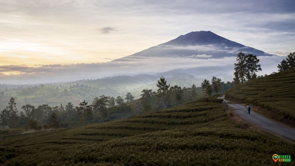
The first question in a helpful Kerinci Valley travel guide shouldn’t be whether or not you can climb Sumatra’s tallest volcano. It should start lower down, where rice fields turn silver after rain, marshes hold a layer of mist, tea rows catch the morning light, and village roads curve around a mountain that doesn’t need to be ascended to define the journey.
Kerinci, in the Jambi Province of Sumatra, is often advertized as a staging area for Mount Kerinci and Danau Gunung Tujuh. The summit-first framing makes the valley seem like a waiting place, although both are serious situations. No it isn’t. The basin itself has enough visual rhythm for a leisurely tour, with agricultural slopes in the north, Sungai Penuh and high observation points in the middle, Lake Kerinci further south and a lake-rich hamlet area encircling Lempur.
This tour is for seven peaceful, scenic stops, not seven main sights. “Calm” is not the same as peaceful, effortless, empty, unexplored. This allows each stop to support a valley-first itinerary with fewer damaging transitions and encourages leisurely observation. Before you leave, make sure you know about any changes to conditions, access, costs and local rules.
Why Is Kerinci a Valley Instead of a Summit?
Mount Kerinci is still an active volcano, rising to a height of 3,805 meters. Although the situation may alter, Indonesia’s geological authorities has consistently supported the crater’s danger restrictions. As a result, a prudent itinerary never suggests that trying to reach the peak will be permitted. Check the official MAGMA Indonesia volcanic alerts, follow park rules, and see any closure as a safety precaution rather than a request for talks.
The context of conservation is equally significant. UNESCO’s 2.5 million-hectare Tropical Rainforest Heritage of Sumatra includes Kerinci Seblat National Park. Due to pressure from infrastructure, encroachment, and other concerns, the serial property has remained on the List of World Heritage in Danger. This is not a vacant wilderness waiting for material, therefore that status should alter the atmosphere of a visit. Communities, operational farms, wildlife corridors, and management boundaries are all part of this protected landscape.
Additionally, a valley-first strategy is more robust. The volcano might be erased for a day by clouds. A trail may become a bad decision due to rain. An afternoon could be consumed by a delayed overland arrival. The trip still has structure if it includes wetlands, field roads, communities, lakes, and vistas. The reasoning is similar to organizing a mist-friendly vacation on the Dieng Plateau: weather is no longer just a forecast that doesn’t work; it becomes an integral part of the visual language.
A Quick Look at the Kerinci Valley Travel Guide
| Zone | Best base | Landscape | Best light | Main caution |
| North | Kersik Tuo / Kayu Aro | Tea, volcano views, wetland | Early morning | Fog, rain, farm traffic |
| Central | Sungai Penuh | City services, hills, viewpoints | Morning or late afternoon | Narrow roads, weekend crowds |
| South | Lake Kerinci / Lempur access | Lake shore, rice, villages | Morning | Longer transfers, limited services |
| Lempur | Village homestay if arranged | Forest-edge lakes and culture | Morning to midday | Guide and access confirmation |
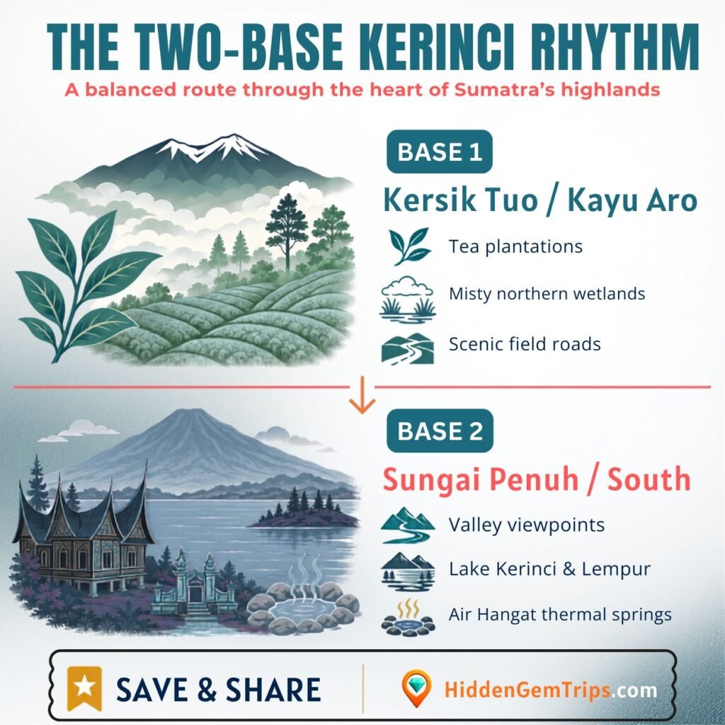
The practical sweet spot is four or five nites with two bases: two nites around Kersik Tuo or Kayu Aro, then two or three nites near Sungai Penuh, or farther south if Lempur is an important part of the plan. For a long, road-dependent valley, this makes the two-base itinerary strategy appropriate. While one base is simpler but results in backtracking, three bases can turn a tranquil trip into daily repacking.
How to Choose Two Bases and Get to Kerinci
Although airline access to local airports varies, the majority of foreign and out-of-region visitors approach overland from the Padang area. A tight bond shouldn’t be built around an estimated drive time. The day can be prolonged by mountain roads, weather, road construction, landslides, traffic, and rest stops. Shortly before departure, confirm the current itinerary with your lodging or a reliable local driver.
If at all possible, arrive during the day. There shouldn’t be any “must-see” stops on the first evening. Check in, dine, find out the weather and pickup time for the next morning, and then go to bed. The idea behind a thorough seven-day plan is particularly applicable here: since the access road is a significant part of the trip, a buffer is not a waste of time.
It can be difficult to verify public transit from a distance because of its scarcity. A car with a local driver is often the most reasonable choice for occasional pauses, especially for tourists who are unfamiliar with left-side traffic, wet mountain roads, or local navigation. Use a scooter only if you are comfortable with rain, rough terrain, animals, low illumination, and have a license, insurance, and experience. “I ride at home” is not a magical shield.
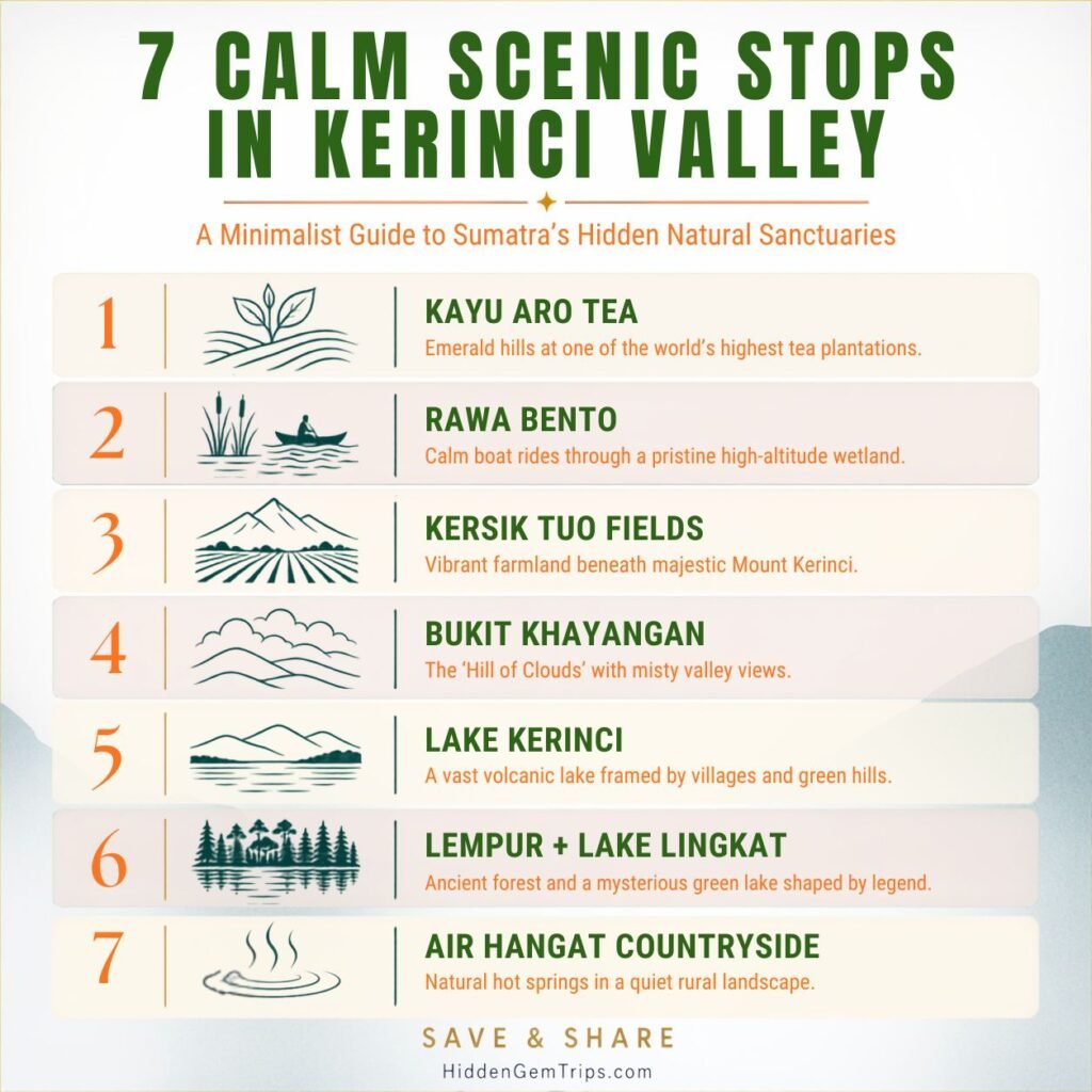
Seven Serene Scenic Destinations in Kerinci Valley
1. Kayu Aro Tea Slopes: Examine the Operational Environment
With its clipped green outlines, cold air, settlement edges, and Mount Kerinci rising behind them when the clouds allow, Kayu Aro’s tea country is Kerinci’s widest visual opening. Avoiding pursuing a single viral opinion is the finest experience. It is choosing safe pull-offs, traveling at a leisurely pace on public highways, and observing how the scenery shifts as cloud shadow moves across the rows.
This is not an outdoor studio, but a working agricultural region. Don’t fly a drone, enter planted rows, obstruct employees, or take close-up pictures of people without authorization. Find out if a factory visit is currently offered and where guests are welcome. The scenery doesn’t require a dubious superlative; claims that the estate is the “largest” or “highest” differ among tourism pages and are rarely defined consistently.
Carry a light layer and rain gear, but arrive early for a better chance of unobstructed mountain views. Cool temperatures, high humidity, mist, and rain can coexist in different districts, as seen by the current BMKG prediction for Kerinci. Verify the particular subdistrict rather than just “Jambi weather.”
2. At first light, let the wetland at Rawa Bento set the pace.
Rawa Bento is the muted opposite of Kerinci’s peak culture. People are drawn to sequence more than spectacle at dawn: the volcano only erupting when the weather permits, a narrow boat sailing through reeds, reflections breaking beneath the bow, and bird sounds reverberating across wide water. Make your reservation with a local operator or accommodation that can confirm the timetable, community arrangements, boat condition, and launch point.
Wetlands are delicate. Keep your hands and waste inside the boat, don’t ask wildlife to chase you for pictures, keep your noise level down, and, if available, wear a properly equipped flotation device. Pushing closer is not as respectful as using a telephoto lens. Beyond traditional Borneo cruises, river towns exhibit the same visitor logic: waterways are inhabited environments rather than corridors in theme parks.
The best way to use Rawa Bento is as a single early morning anchor, followed by breakfast and a leisurely return via Kayu Aro. Don’t combine it with a strenuous hike on the same day. When a quiet pause becomes item number one of six, its value is diminished.
3. The Volcano Without the Summit: Kersik Tuo Field Roads
Although Kersik Tuo is regarded as a trekking entrance, its field roads offer a more convenient approach to comprehend the size of the volcano. Stay away from crops, get permission before taking pictures of farmers or homes, and only stroll along public or clearly marked paths. When routine tasks continue to be routine—cabbages, potatoes, tea, motorcycles, school traffic, and clouds passing over the cone—the tableau is at its most powerful.
Instead of following an internet pin into private territory, choose a quick loop with your host. Step completely off the road for cars and wear clothes that is visible in poor light. Return if you see local warnings, thunder, heavy rain, or volcanic ash. It is not worth it for a lovely frame to become someone else’s rescue issue.
This slower reading of a farmed highland is similar to the method used in the Harau Valley guide, where fields and cliffs make more sense when villages are viewed as habitations rather than as background landscapes.
4. Bukit Khayangan Perspective: Recognize the Basin’s Shape
Bukit Khayangan is helpful above Sungai Penuh because it transforms a group of stops into geography. The city, lake, fields, and stacked ridges can be seen in open spaces. Even amid cloud cover, a brilliantly exposed panorama may not be as captivating as the rise and fall of mist.
Visit early in the morning or late in the afternoon, and return during the day. Verify the current state of the roads, the hours of operation, and the costs locally; internet postings may be outdated. Wet surfaces can be slick, and fog makes it harder to see on the approach. Gravity is still stubbornly unaffected by content strategy, so don’t stand in the way of photos or think walls are made to be climbed.
Instead of using this as a lengthy checklist visit, use it as an orientation stop. Trace the locations of the northern and southern stops using a single map or offline map layer. The next travel day will be easy to read after that little deed.
5. Select a Village-Scale View of Lake Kerinci’s Quieter Shore
Although “visit the lake” is too ambiguous to be helpful, Lake Kerinci is a significant valley landmark. Settlements, roads, farmed land, fishing activities, and vantage spots with varying access conditions are all found along the seashore. Request a safe, lawful shore stop from a local host or driver that doesn’t cross private property or obstruct boats and nets.
There is usually less traffic and softer light in the early morning. Take more time to sit than is necessary for the picture. Observe how daily movement collects along the shore and how the wind modifies the surface. Water quality, depth, currents, boat traffic, and access regulations are not evident on a postcard, therefore avoid swimming unless a reliable local authority certifies that the precise region is safe and allowed.
The method is comparable to touring Lake Toba through its village stops: the water serves as the geographical anchor, but the important features are found in communal rhythms and functional shorelines.
6. Lempur Village and Lake Lingkat: A Softer Southern Anchor
A lake-rich cultural landscape is reduced to a single image by concentrating only on the blue forest lake, despite the fact that Lempur is often portrayed as the entry point to Danau Kaco. Start by inquiring about what is seen in the village on that particular day. Lake Lingkat or another lake that is suggested locally may offer a gentler, less taxing experience, depending on current access and community arrangements.
Danau Kaco should be considered a separate guided woodland trek rather than a roadside attraction. Check the weather, turnaround time, river crossings, trail conditions, park permits, guide needs, and waste rules. Don’t reveal the exact locations of delicate wildlife. UNESCO’s conservation classification serves as a warning that “hidden” does not mean “impact-free.”
Lempur should be treated with the same decency as the village-focused respectful travel checklist, which includes paying agreed-upon local fees without turning every encounter into a bargain hunt, asking permission before visiting compounds or places of worship, greeting before taking pictures, and dressing appropriately for social situations.
7. The Air Hangat Countryside and Semurup: A Low-Key Closing Loop
The trip concludes with a more subdued note in the Air Hangat area, which features village life, agricultural routes, and geothermal links surrounding Semurup. Before visiting a public hot spring, make sure it is open, clean, and suitable for swimming. Access conditions and facilities may change. Unmanaged geothermal water should never be entered because of the potentially dangerous temperature, gasses, and unstable ground.
A quick loop around the countryside with one confirmed stop, a local supper, and no pressure to create a spectacular ending is the better strategy. This is when the valley-first reasoning in the paper becomes evident. Tea, wetlands, pastures, hill vistas, lakeshore, village lakes, and regular roads all contribute to Kerinci’s allure.
In the Garut highlands, where the distance from a big city is less important than the route’s slow pace, travelers who like this kind of near-home highland rhythm may also value peaceful getaways.
A Four-Day Slow Kerinci Itinerary
| Day | Base | Morning | Afternoon / evening |
| 1 | Kersik Tuo | Arrive and recover | Short field-road orientation; early night |
| 2 | Kersik Tuo | Rawa Bento at dawn | Kayu Aro tea roads; weather buffer |
| 3 | Sungai Penuh | Transfer south with Bukit Khayangan if clear | Lake Kerinci shore; settle in |
| 4 | Sungai Penuh or south | Lempur and a locally approved lake | Return before dark or stay locally |
| 5 optional | Sungai Penuh | Air Hangat / Semurup loop | Departure buffer |
Don’t use the table as a guaranty. This model is a sequence. Move Kayu Aro to the morning and save the wetland for a later time if Rawa Bento is unable to function. Proceed south if the view is obscured by clouds. Spend additional time at Lake Kerinci instead of making a late return if entrance to Lempur is doubtful. A well-designed remote itinerary is flexible.
Set enough money for complete travel days, the cost of a local guide or boat, driver wait times, delays due to rain, and an additional nite. The cheapest quoted transfer is not the same as the actual cost of reaching a dispersed highland valley, which is why the remote-trip cost framework is helpful.
Reality of the Road, Volcano, Weather, and Conservation
Kerinci is extremely changeable in elevation, damp, and chilly by Indonesian lowland norms. As the horizon gets longer, weather forecasts become less reliable, so utilize BMKG for short-term planning and find out from local hosts what has actually happened on the road or trail. Bring sun protection, a dry bag, a lightweight waterproof layer, a warm layer for daybreak, and shoes with genuine traction. For remote travel, a thorough packing-light strategy helps prevent using a big luggage to deal with the weather.
Volcanoes’ status cannot be compromised. Never cross a closure, enter a restricted area, or take a tour advertisement at face value. Ask the present management or a respectable local operator to confirm the rules and permissions for park areas. Avoid driving at nighttime if at all possible, and allow additional time for long-distance transports or flights.
Examine medical limits, evacuation, trip interruption, activity exclusions, altitude regulations, volcanic event language, motorbike conditions, pre-existing condition terms, age restrictions, and Indonesia availability before purchasing insurance. You can examine the available SafetyWing travel insurance alternatives if it passes that independent examination.

Traveling Sensibly in Kerinci Villages
Kerinci’s tranquility hinges in part on tourists not turning every peaceful area into a geotagged bustle. Before taking pictures of people, farms, ceremonies, interiors, boats, and kids, get permission. Never fly a drone without first checking the weather, local permission, park limits, national regulations, and privacy. Never encourage guides to bait, call, or chase animals, and keep precise wildlife locations confidential.
Where the service is appropriate, purchase meals, coffee, transportation, guiding, and homestays locally. Before leaving, decide on the scope and cost, then make a just payment. Learn a few pleasantries in Indonesian and allow the local guide to facilitate discussions in the communities. This guide’s destination-readiness considerations are particularly pertinent in this context: online novelty is less important than access, waste, emergency capacity, community permission, and conservation regulations.
Lastly, avoid calling locations “untouched,” “empty,” or “yours to discover.” Long histories, dialects, farms, institutions, religious relationships, and tensions over conservation are all present in Kerinci. An story about travel can draw attention without claiming that the visitor created the scenery.
Let the Valley Be the Final Destination
A successful summit is not necessary for Kerinci to justify the trip. Below the crater, it exhibits its strongest slow-travel sequence: The working tea slopes of Kayu Aro, the first light of Rawa Bento, the field roads of Kersik Tuo, the basin view of Bukit Khayangan, a more serene Lake Kerinci beach, the village-lake landscape of Lempur, and the farmland of Air Hangat.
Plan two bases, shield daylight, check every living situation, and provide space for the best mornings. The valley has not failed if the cloud covers the volcano. It is giving you the motivation to stay long enough to take in everything else.
FAQ
1. In the Kerinci Valley, how many days are needed?
Four nites is a fair minimum for a valley-first tour, but five or six nites provide better weather and road buffers. Give yourself more time for any strenuous hike. Two-night itineraries are vulnerable to cloudy and longer access days.
2. Is it possible to enjoy Kerinci without ascending Mount Kerinci?
Indeed, a comprehensive picturesque route is formed by Kayu Aro, Rawa Bento, Kersik Tuo field roads, Bukit Khayangan, Lake Kerinci, Lempur, and the Air Hangat countryside. The summit ought to be viewed as a distinct, contingent goal.
3. What base works best in Kerinci Valley?
Use Sungai Penuh for center services and southern access, and Kersik Tuo or Kayu Aro for northern stops. Travelers that prioritize Lempur may make reservations for a local stay, contingent on community arrangements and current availability.
4. Is it safe for solo visitors to visit Kerinci Valley?
Distances, weather, mountain roads, restricted transportation, park regulations, and volcanic activity all call for caution, but it can be manageable with preparedness. Verify the present situation, avoid restricted regions, utilize trained local guides where necessary, and don’t drive farther than you are comfortable.
5. What time of year is ideal for visiting Kerinci?
No month ensures unobstructed views of the mountains. Although rain and mist happen all year round, many travelers choose to go during more dry times. Near departure, check BMKG, factor in buffer days, and plan a path that will still be profitable in the event of a cloud.
Disclaimer
This article is not a live safety bulletin, park permit, weather forecast, immigration guide, medical advise, or insurance advice; rather, it is for general trip planning information. Regulations, weather, transportation, amenities, taxes, road and trail access, and volcano status are all subject to sudden changes. Before taking any action, confirm the situation with park management, lodging, certified local operators, and official Indonesian authorities.
Affiliate disclosure: There may be affiliate links in this article. Hidden Gem Trips may receive a commission at no additional cost to you if you make a purchase from an eligible authenticated link. Research is not presented as personal use or first-hand travel experience, and affiliate ties do not dictate which places or services are covered.