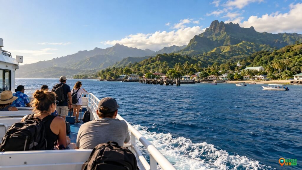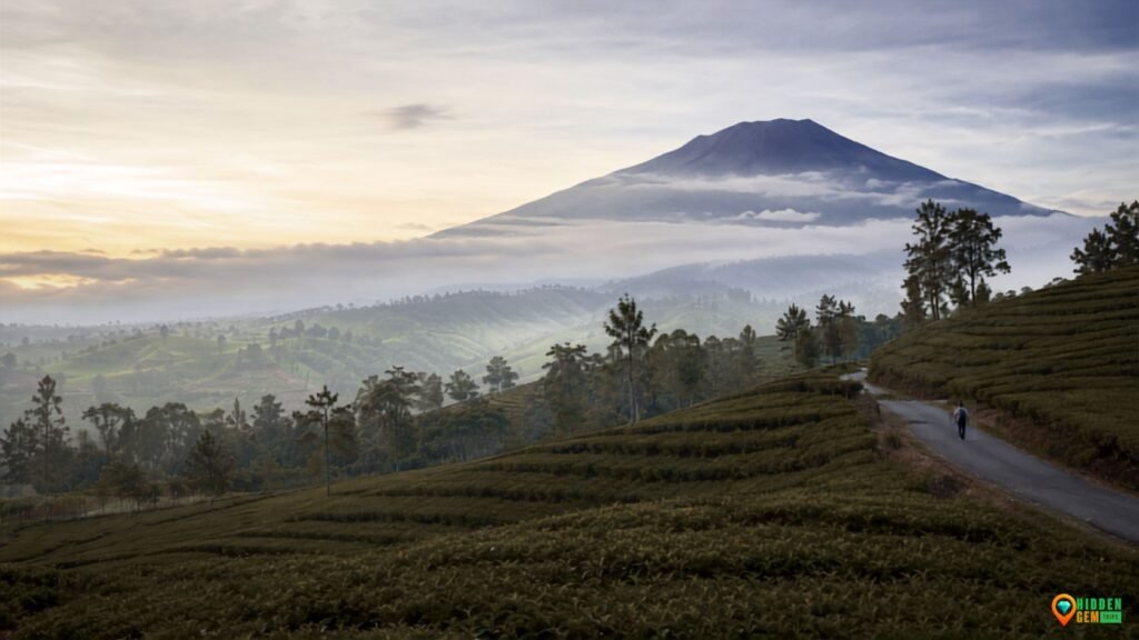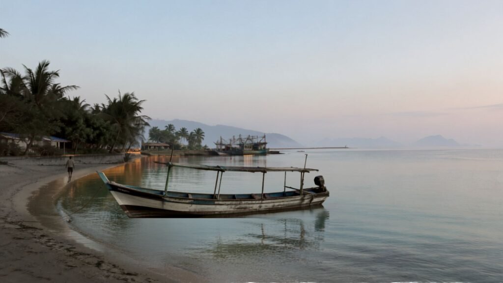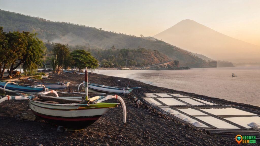

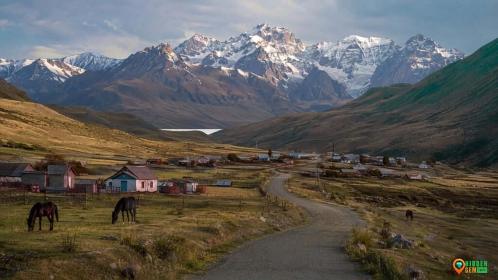
Kyrgyzstan Alpine Villages are frequently presented as picturesque stops in between well-known lakes and steep climbs. They are undersold by that. Whether a mountain excursion feels expansive or turns into a flurry of washboard roads, hasty photographs, and optimistic arrival times plagiarized from a map depends on the village base.
The country is intensely mountainous, but “mountain village” is not one uniform product. Jyrgalan has developed a visible network of guesthouses and outdoor routes. Sary-Mogol sits high in the Alay Valley and faces a very different weather and altitude equation. Arslanbob is wrapped in walnut forest rather than treeless alpine pasture. At-Bashy is less postcard-polished, yet more useful for understanding the logistics behind journeys toward the Chinese border zone.
Seven villages are chosen by this guide as bases rather than awards. It explores what each location makes possible, how brittle access might be, and whether staying put is a better course of action. Road conditions, permits, border regulations, guesthouse availability, and trail conditions should all be confirmed right before leaving because conditions in Kyrgyzstan can change rapidly.
Why Alpine Villages in Kyrgyzstan Require a Different Approach to Planning
Villages are ranked by visual drama according to the standard listicle methodology. That's amusing, but it's not complete. You can learn very little about Kyrgyzstan from the distance between two pins. A road may be paved, damaged, under construction, blocked by snow, or slowed down by animals. A permission, a high-clearance vehicle, a horse, a long walk, or all four might be necessary for a “nearby” lake. An online yurt camp might not be a permanent colony but rather a seasonal enterprise.
First, divide the three layers:
1. The village: a year-round settlement with homes, shops, farms, educational institutions, and regional transit networks.
2. The activity zone: which includes pasture roads, woodlands, valleys, trailheads, and vantage points accessible from that community.
3. The seasonal layer: yurt camps, horse routes, high passes, and services that appear mainly in the warmer months.
That distinction matters for responsible planning. It prevents a seasonal camp from being treated like a guaranteed hotel and stops a resident community from being described as an attraction. Hidden Gem Trips’ guide to judging whether a remote place is genuinely ready for visitors offers a useful test: access, waste, water, local consent, emergency capacity, and community benefit should all influence the decision to go.
The lens is also different from a road and river trip through northern Laos, a hut-to-hut mountain tale like Albania's Accursed Mountains, or the vehicle-led logic of Morocco's more sedate valleys. The village network in Kyrgyzstan necessitates a unique mix of shared transportation, altitude pacing, seasonal pasture access, and permission knowledge.
The tourism industry is expanding rapidly. According to Kyrgyzstan's National Statistical Committee, the country's organized and unorganized tourist sectors served 5.3 million people in 2025, a 45% increase from 2024. The organized sector served over 3.57 million people, while the unstructured sector served roughly 1.73 million. The statistic should not be interpreted as a straightforward airport headcount because such groups are not the same as unique international holiday arrivals. It does demonstrate why capacity-aware coverage is preferable than another “go before everyone else” rush for smaller destinations. For the most recent data and definitions, consult the official Kyrgyz tourist statistics.
An Overview of Kyrgyzstan's Alpine Villages
| Village | Approx. elevation | Best role | Practical season | Main planning catch |
| Jyrgalan | 2,450 m | Day hikes and multi-day trail base | June–September; winter for specialist snow trips | Fast-changing mountain weather |
| Sary-Mogol | 2,980 m | Alay Valley acclimatization and Pamir views | Late June–September | High altitude and long approach from Osh |
| Kyzyl-Oi | 1,800 m | Slow road-trip pause and Kokomeren landscapes | May–October | Public transport is limited and indirect |
| Arslanbob | 1,600 m | Forest walks, waterfalls, and village stays | May–October | Trails and harvest activity are seasonal |
| At-Bashy | 2,000 m | Logistics base for Naryn borderland routes | June–September for high routes | Border-zone permits and long 4WD days |
| Tamga | 1,700 m | South Issyk-Kul base with canyon and valley access | May–October | Attractions are spread out; transport planning matters |
| Tuura-Suu | 2,200 m | Small-village access toward jailoo landscapes | June–September | Minimal services and route-name confusion |
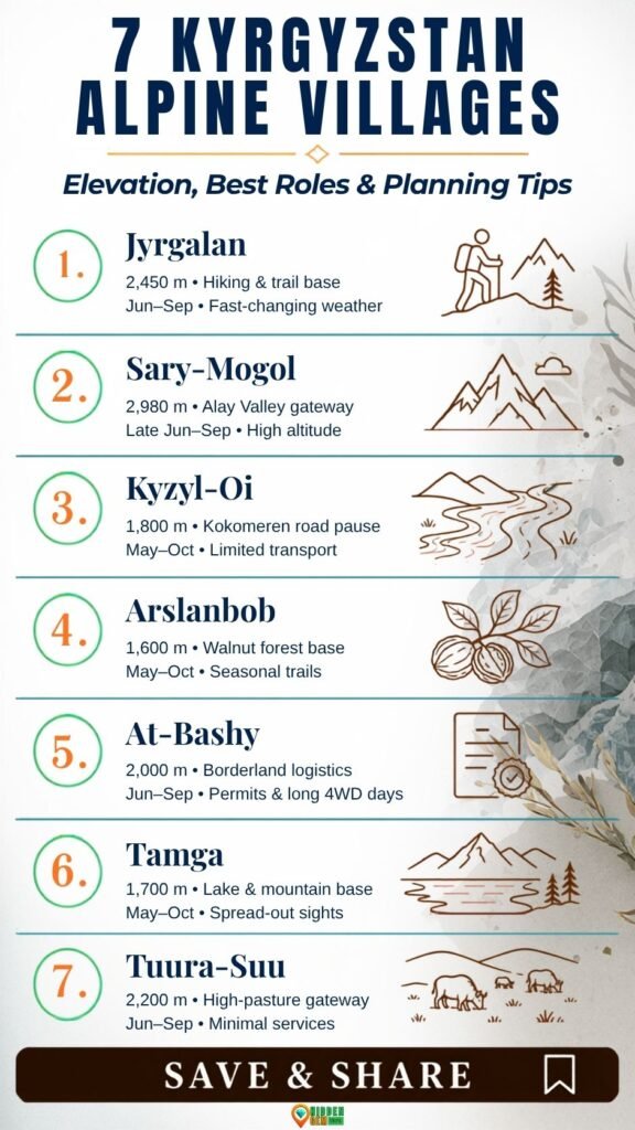
Elevations are not survey measures; rather, they are rounded planning calculations. Compare acclimatization requirements using them, then confirm the precise trailhead and sleeping elevations for each trek.
7 Alpine Villages in Kyrgyzstan for Untamed but Practical Getaways
1. Jyrgalan: The Eastern Base Prepared for Trails
The simplest place on this list for those who desire a rural stay connected to a genuine menu of outdoor possibilities is Jyrgalan, which is located in the Issyk-Kul Region east of Karakol. From a former mining village to a community of guesthouses, guides, and signposted or frequently used trails, its tourist tale has evolved recently. The location is more complex than the ideal of a timeless alpine village because of its past.
Choice is the practical benefit. Longer plans connect to lakes, passes, horse paths, and multi-day treks; shorter walks can follow the valley and lower slopes. Rather than risking the trip on a single summit day, you can factor weather slack into your stay. Jyrgalan offers the more subdued mountain beat, while Karakol continues to be the sensible transportation and supply center.
Better organization does not equate to assurance at the resort level. Inconsistent trail markings, fluctuating river levels, persistent snow, and a beautiful morning turning chilly without any fanfare are all possible. Carry an offline map, inquire with the host about the precise route on that particular day, and make an early return when visibility deteriorates. Avalanches, landslides, rockfall, sudden weather changes, summer snow, sun exposure, and altitude sickness are all cautions in the UK government's trekking guidelines for Kyrgyzstan.
Ideal for: trekkers seeking a quieter option to spending every nite in Karakol, as well as flexibility and guesthouse help.
Stay: Spend two or three nites there.
Plan B: if higher routes are dangerous, take hikes in the valleys, eat local food, and take a day off.
2. Sary-Mogol: A High Threshold in the Alay Valley
Sary-Mogol is located in the expansive Alay Valley at a height of around 3,000 meters, and the Trans-Alay range forms an impressive southern wall. It is frequently utilized for treks like Traveler's Pass, views of Lenin Peak, and access to Tulpar-Kol. The temptation to come from Osh and start a demanding day right away is as great as the visual scale.
Avoid giving in to that temptation. For many travelers, sleeping near 3,000 meters is already an altitude experience. Make the first afternoon easy, drink plenty of water, refrain from overdoing it, and keep an eye out for headaches, nausea, lightheadedness, unusual exhaustion, or poor coordination. When symptoms get worse, it's crucial to descend; toughness is not an acclimatization tactic.
Sary-Mogol also reveals why village-based coverage is more honest than lake-only coverage. Tulpar-Kol camps are seasonal. The village offers a more stable point for asking about current road conditions, arranging transport or horses, and deciding whether the mountains are actually open for the plan in your head. A flexible itinerary is essential; the two-base itinerary method is particularly useful if Osh and Sary-Mogol become the two anchors rather than a string of one-night stops.
Ideal for: tourists who can plan acclimation and appreciate high-altitude scenery.
Stay: If you're going higher, stay for at least two nights.
Plan B: village time and low-effort valley views instead of a pass crossing.
3. Kyzyl-Oi: Red Cliffs on the Kokomeren Road
Kyzyl-Oi sits beside the Kokomeren River on a dramatic road between the Chüy side of the country and the Song-Kul/Naryn region. The village is framed by dry, red-brown mountains instead of glacier scenery. That contrast is precisely its strength: the landscape feels sculptural, and the journey follows one of Kyrgyzstan’s most memorable river corridors.
This is a slow-road escape more than a checklist destination. Walk the lanes without photographing people at close range, follow local advice for safe riverside viewpoints, and notice how irrigation, pasture, and road traffic shape daily life. Kyzyl-Oi works best as a deliberate overnight break. Treating it as a quick lunch stop misses both the evening light and the village's real value—breaking a demanding overland transfer into humane pieces.
Independent transport can be awkward. Shared vehicles may not match a visitor’s schedule, while private drivers raise the budget. Do not calculate the trip using fuel alone. The site’s remote-trip budget framework accounts for empty return legs, driver waiting time, weather buffers, cash needs, and last-minute rerouting.
Best for: photographers, road-trip travelers, and anyone who prefers inhabited valleys to peak collecting.
Stay: one or two nights.
Plan B: use the village as a recovery stop if Song-Kul access is delayed.
4. Arslanbob: Walnut Forests Replace Bare Peaks
Arslanbob alters the article's texture. It is famous for its large walnut-fruit trees, village roads, waterfalls, and grazing trails. It is located in the Jalal-Abad Region beneath the Fergana Range. Compared to the exposed Alay Valley, the experience is more populated, more agricultural, and greener.
The forest is not an empty recreation park. It supports livelihoods and becomes especially active around the walnut harvest. Travelers should stay on locally recommended paths, avoid taking nuts or fruit without permission, and ask before photographing people at work. A locally arranged guide can add context about forest use, land, and seasonal routines without pretending that every story is timeless folklore.
Arslanbob can support easy walks, longer hikes, horse trips, or simply a slower homestay. That range makes it suitable for mixed-ability groups. Waterfall paths can still be slippery, and distance estimates vary by route. Clarify whether a quoted time means walking one way, a round trip, or a vehicle-assisted excursion.
The village also serves as a useful counterweight to the language of “wild escape.” Wildness here coexists with orchards, homes, grazing, and work. Follow a respectful village travel checklist rather than treating privacy as the price residents pay for living somewhere photogenic.
Best for: forest landscapes, cultural context, families, and travelers who do not need a high pass every day.
Stay: two or three nights.
Plan B: shorter forest walks and village meals during unstable weather.
5. At-Bashy: A Working Town Before the Borderlands
At-Bashy is not the prettiest name on a social-media itinerary, and that is exactly why it belongs. South of Naryn, this working settlement provides services and local connections for routes toward Tash Rabat, Chatyr-Kul, Kel-Suu, and other high borderland landscapes. Some travelers rush through while chasing the more famous attraction. Staying overnight produces a more realistic schedule and reduces the risk of stacking a long transfer onto an already demanding excursion.
The critical issue is permits. Kel-Suu and other destinations near the Chinese frontier lie within regulated border zones. CBT Naryn’s border-zone information explains that Kyrgyz authorities require a permit for certain areas, including Kel-Suu. Requirements, processing times, eligible pickup arrangements, and passport-document rules can change. Apply well ahead through a legitimate organizer, carry the requested original documents, and do not assume a permit can be improvised at a checkpoint.
Even with paperwork, access is conditional. Roads cross high, exposed terrain and can be rough, muddy, snowy, or temporarily impassable. Kel-Suu’s water level also varies; no ethical operator can guarantee the exact turquoise photograph seen online. Choose a driver, vehicle, and departure time for recovery margin, not bravado.
Best for: logistics-minded travelers who want to understand the region beyond a single lake image.
Stay: one night before and possibly one after a borderland excursion.
Plan B: Naryn-region cultural and valley routes outside the restricted zone.
6. Tamga: A South-Shore Base with Mountain Options
Tamga lies on the southern side of Issyk-Kul, where the lake road gives access to dry canyons, beaches, hot-spring valleys, and the northern approaches of the Terskey Ala-Too. It is less alpine in the center than Jyrgalan or Sary-Mogol, but it functions well as a lower sleeping base while travelers sample higher terrain by day.
The value is strategic. South-shore attractions are spread across a long corridor; changing accommodation every night wastes time. From one base, a traveler can choose between gentle lake time, the Barskoon valley, Skazka Canyon, craft or eagle-hunting demonstrations arranged with consent, and longer mountain outings when conditions cooperate. Apply the same logic used in Hidden Gem Trips’ seven-day itinerary rules: depth usually comes from fewer transfers, not more pins.
Ethical judgment matters around wildlife demonstrations and staged cultural activities. Ask how animals are housed and handled, what the fee supports, whether photography is welcome, and whether the presentation reflects a community-led practice or a rushed roadside transaction. “Authentic” is not a magic label that removes the need for questions.
Best for: mixed-interest groups and travelers seeking lake-plus-mountain variety.
Stay: two or three nights.
Plan B: lake shore, canyon visits, or village-based activities when high valleys are clouded in.
7. Tuura-Suu: A Small Gateway to High Pastures
Tuura-Suu in the Tong District is a small settlement south of Issyk-Kul, positioned for routes toward pasture country and less-developed mountain valleys. It suits travelers who want the scale of the landscape without Jyrgalan's activity menu. The trade-off is obvious: fewer services mean more responsibility to arrange transport, meals, translation, and contingencies in advance.
Navigation deserves extra attention because similarly named places occur in the region and spellings vary across Latin transliterations. Send a map pin to the driver and host, confirm the district, and save the contact details offline. That tiny step prevents the kind of comedy that stops being funny after the second wrong valley.
Do not publish real-time coordinates for fragile campsites or private pasture homes without permission. Ask where vehicles should stop, whether a local guide is expected, and how fees are distributed. If the community cannot comfortably host more visitors on a given date, accept the answer. The goal is not to “discover” a place harder than everyone else; it is to leave local control intact.
Best for: experienced independent travelers, small groups, and slow landscape observation.
Stay: one or two nights with arrangements confirmed.
Plan B: return to the south-shore corridor rather than pushing deeper in bad weather.
How to Build a Route Without Turning It Into a Windshield Tour
These seven villages should not be forced into one trip. Jyrgalan and Tamga combine naturally around Issyk-Kul. Kyzyl-Oi can connect a Bishkek departure with Song-Kul or Naryn. At-Bashy belongs to a Naryn-focused route. Arslanbob and Sary-Mogol fit a southern itinerary using Osh as the transport hub, although they lie in different directions and still require substantial driving.
A realistic first mountain trip can use one of three clusters:
| Route cluster | Suggested length | Core bases | Why it works |
| Eastern mountains | 7–9 days | Karakol/Jyrgalan + Tamga | Guesthouse depth, lake recovery time, flexible hiking |
| Central road and borderlands | 7–10 days | Kyzyl-Oi + Naryn/At-Bashy | Breaks long drives and leaves room for permit-dependent plans |
| Southern contrast | 8–11 days | Osh + Arslanbob or Sary-Mogol | Choose forest or high Alay focus instead of racing between both |
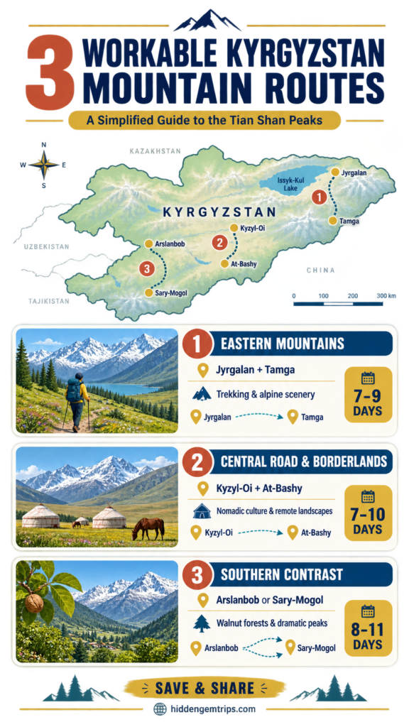
For a short trip, choose two bases and one major transfer day. For a longer trip, add a third region only if you have two buffer days. The packing-light guide for remote expeditions can help keep shared taxis and homestay arrivals manageable, while the remote-road gear checklist covers power, water, dust, rain, and communication failures.
The Access Reality: Roads, Permits, Weather, and Altitude
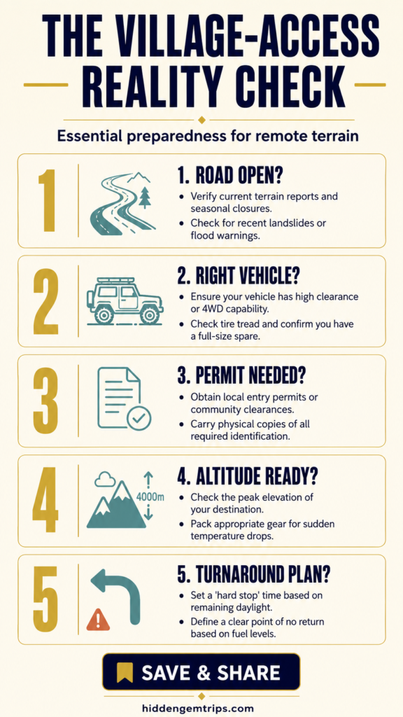
Write mountain plans in pencil. Ask hosts or drivers four questions before every remote departure: Is the road physically open? Is the vehicle suitable today? Are permits or checkpoints involved? What is the turnaround time if conditions worsen?
While they offer a helpful starting point, government advisories should not be used in place of local checks. As of 31 August 2026, the U.S. travel advisory for the Kyrgyz Republic advises increased caution within 30 kilometers of the Tajikistan border and notes that border-crossing status can change with little warning. That matters most for southern and southwestern routing; always check the advisory relevant to your nationality and the exact itinerary shortly before travel.
Altitude is another route-design issue. A village night at 2,980 meters is not equivalent to one at 1,600 meters. Ascend gradually when possible, keep the first day light, and make sure everyone can recognize symptoms. Evaluate travel insurance only after reading exclusions for trekking elevation, horse riding, remote evacuation, search and rescue, pre-existing conditions, and destination coverage. Compare policies independently; if it fits your circumstances, review the current terms on SafetyWing’s official site before buying. A logo is not coverage—boring policy wording wins this round.
Connectivity is unreliable outside larger towns. Download maps, booking details, translations, passport copies, and emergency contacts. Carry cash in small denominations, but divide it between secure locations. Tell a trusted person the route and check-in schedule. For longer treks, consider a satellite communicator and a qualified local guide; never describe a phone signal as an emergency plan.
Responsible Stays in Kyrgyzstan’s Mountain Communities
Community tourism can direct money toward households, drivers, guides, cooks, horse handlers, and craftspeople. It can also concentrate pressure or reward only the most visible operators. Ask what is locally owned, book directly when practical, and spread spending across meals, guiding, transport, and crafts rather than negotiating every household service to the floor.
Basic etiquette travels well:
• Ask before photographing people, homes, livestock work, religious spaces, or children.
• Accept that a guesthouse is both a business and somebody’s home.
• Dress and behave with situational respect; rural norms may be more conservative than resort areas.
• Use water carefully, especially where washing facilities are simple.
• Carry out batteries, wipes, packaging, and other waste that local systems cannot process.
• Do not fly a drone without checking national rules, border-zone restrictions, local consent, wildlife impact, and guest privacy.
• Avoid geotagging private homes, fragile pasture sites, or culturally sensitive locations without permission.
The point is not to perform perfect traveler virtue. It is to reduce the number of problems a host must quietly solve after you leave. The broader slow-travel approach is useful here: staying longer and moving less can improve both the reader’s trip and the community’s share of its value.
What to Pack Without Carrying an Expedition Store
Pack for temperature swings and service gaps, not for an imaginary summit attempt. A layered system usually works better than one heavy coat: a moisture-managing base layer, a warm mid-layer, a windproof or waterproof shell, a hat, gloves, and sun protection. Add sturdy footwear appropriate to the chosen routes, a small first-aid kit, water treatment, power bank, headlamp, offline navigation, and any personal medication in sufficient quantity.
The useful gear changes by village. Jyrgalan and Sary-Mogol demand heavier rain, cold, and navigation preparation. Kyzyl-Oi and Tamga add dust and sun exposure. Arslanbob may mean muddy forest paths. At-Bashy borderland trips require document protection and enough food and water for delays. Start with conditions, then choose equipment; shopping the other way around is how backpacks become mobile cupboards.
Conclusion: Choose Fewer Villages and Stay Longer
The best Kyrgyzstan Alpine Villages are not the seven that fit most efficiently into a caption. They are the one or two that match your transport tolerance, altitude readiness, interests, and weather window.
Choose Jyrgalan for a developed hiking base, Sary-Mogol for high Alay scale, Kyzyl-Oi for a river-road pause, Arslanbob for working forest landscapes, At-Bashy for borderland logistics, Tamga for flexible lake-and-mountain days, or Tuura-Suu for a small-base journey that demands more preparation. Then leave space in the schedule. In Kyrgyzstan, that space is not wasted time. It is where a delayed road, a long meal, a safer weather decision, or an unplanned extra night can become the part of the trip that actually breathes.
Frequently Asked Questions
1. What is the best time to visit Kyrgyzstan Alpine Villages?
Late June through early September is the most reliable window for high villages, summer guesthouses, yurt camps, horse routes, and mountain passes. Lower places such as Arslanbob, Kyzyl-Oi, and the Issyk-Kul corridor may work in a broader May-to-October window. Snow, rain, road damage, and seasonal business dates vary each year, so confirm locally.
2. Can these villages be visited without a tour?
Several can be reached independently, especially Jyrgalan, Arslanbob, Tamga, and larger transport corridors. Private drivers or locally arranged transfers become more practical for Kyzyl-Oi, Tuura-Suu, and remote routes beyond At-Bashy. Guided support is advisable for unmarked treks, horse trips, winter travel, or any plan with difficult evacuation.
3. Is a border permit necessary for remote areas like Kel-Suu?
Kel-Suu and some locations near the Chinese frontier require a Kyrgyz border-zone permit. Rules and processing arrangements can change. Use an established local organizer, apply well ahead, and verify which passport copy, dates, pickup method, and original documents are required.
4. Is Sary-Mogol too high for a first night in the mountains?
At roughly 2,980 meters, Sary-Mogol can cause altitude symptoms, particularly after a rapid ascent from a much lower elevation. Plan a light arrival day, know the symptoms, and descend if they worsen. Anyone with relevant medical issues should speak with a specialist before traveling.
5. Are homestays available throughout the year?
Some hamlet guesthouses are open year-round, while many mountain services, yurt camps, guides, and transportation arrangements are seasonal or require advance notice. Winter access may need specialist vehicles, additional insurance, and awareness of avalanches. Verify right away rather than relying on an out-of-date booking listing.
Disclaimer
This article is for general travel-planning information, not medical, legal, security, insurance, or mountaineering advice. It is based on desk research and does not claim that the author visited, tested, or personally used the destinations, routes, operators, accommodation, equipment, or insurance mentioned. Elevations, journey times, road conditions, border rules, permits, trail access, prices, and seasonal services are subject to change. Check official government advice, local authorities, qualified guides, hosts, transport providers, and your insurer before booking or departure. Never continue into closed, restricted, or unsafe terrain because an online guide described it as accessible.