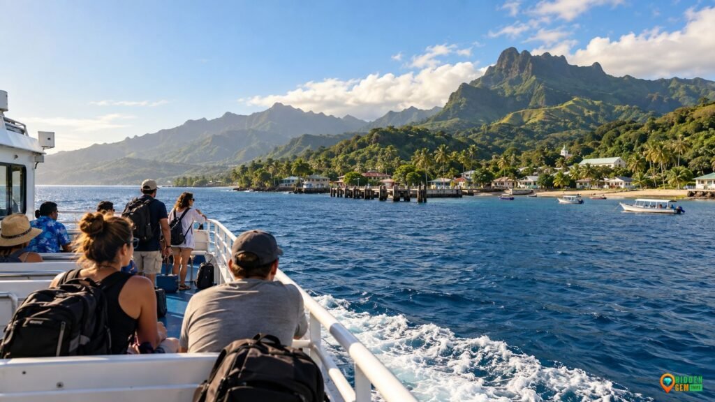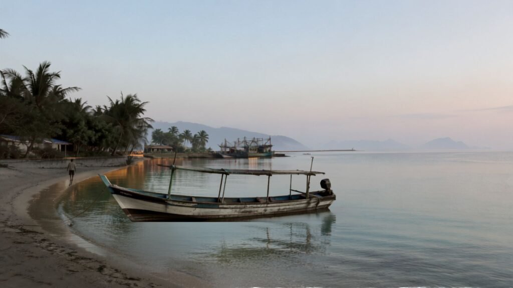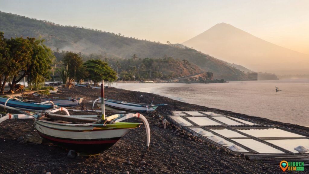

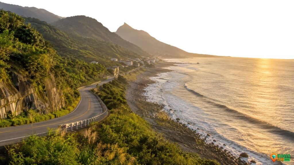
Taiwan’s east coast is the quieter counterweight to the island’s most familiar urban and mountain itineraries. Between Hualien and Taitung, the Pacific meets a narrow strip of settlements, rice terraces, working harbors, Amis communities, uplifted coastal geology, surf beaches, and rail-accessible valley towns. The official East Coast National Scenic Area describes a long coastal landscape shaped by tectonic uplift, volcanic and sedimentary rock, beaches, reefs, terraces, caves, fishing villages, and Indigenous culture. The result is a route that rewards attention more than speed.
This Taiwan East Coast guide uses seven towns and scenic stops as planning anchors rather than trophies. The point is not to “complete” Highway 11. It is to build a route with enough space for weather, public transport, local businesses, cultural context, and the simple fact that a working landscape deserves more than a drive-by photo. If you are browsing the wider Hidden Gem Trips library, the Global Gems travel guides and practical travel-planning guides use the same research-led approach.
Why the Taiwan East Coast Rewards Slower Travel
The east is geographically compact but operationally slow. The Pacific side is exposed to wind, rain, swell, earthquakes, and occasional typhoon disruption; mountain-backed roads and small settlements can make short distances feel longer than a map suggests. That is not a flaw in the route. It is a reason to plan fewer major stops per day and keep one flexible block in every two or three days.
Official tourism material describes the East Coast National Scenic Area as roughly 170 kilometers from the Hualien River area south toward Taitung, with the Pacific to the east and the Coastal Mountain Range to the west. It also identifies the coast as a primary homeland of the Amis people. That matters because villages are not decorative scenery. Festivals, fishing, farming, churches, temples, schools, family homes, and local businesses are part of a living region, not a themed route created for visitors. See the official Taiwan Tourism overview of the East Coast for the broader regional context.
Weather should be treated as a planning variable, not an inconvenience to overpower. Before exposed coast walks, surf stops, or long road days, check the Central Weather Administration for current forecasts and warnings. After major rain, earthquake activity, or local closure notices, use official transport and attraction pages rather than relying on an old itinerary screenshot.
Before You Plan: Coast, Valley, or Both?
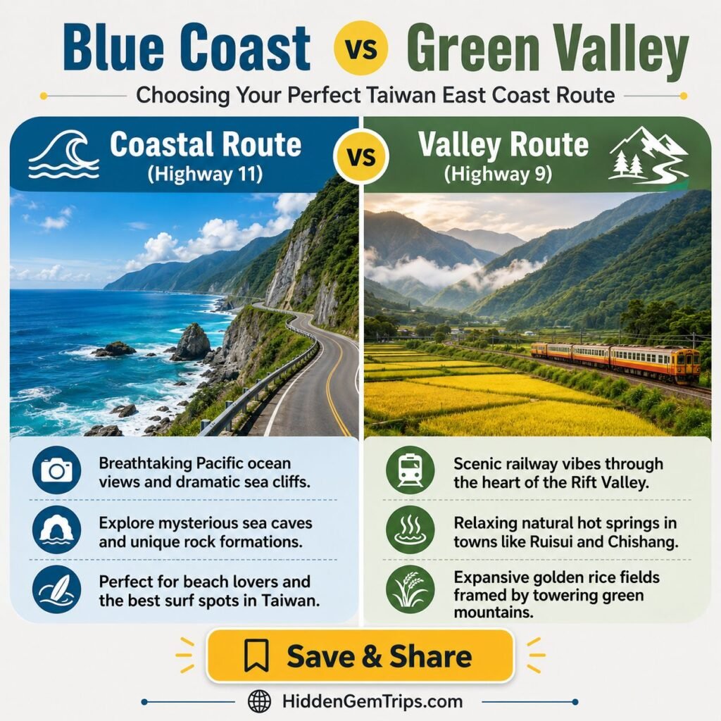
The simplest way to understand eastern Taiwan is to separate two travel rhythms. The “blue” route is Highway 11 along the Pacific: Fengbin, Shitiping, Changbin, Chenggong, Donghe, Dulan, and smaller coastal stops. The “green” route is the East Rift Valley and rail corridor: Ruisui, Yuli, Fuli, Chishang, Guanshan, Luye, and Taitung. The coast is more exposed and visually dramatic. The valley is easier to structure around trains, farms, hot springs, and recovery days.
For a first trip, a blended plan usually works better than choosing one side for the entire journey. Use Hualien as the northern gateway, spend one or two days on coastal Highway 11, continue to Chenggong or Dulan, then use Taitung as a practical southern base. If you have more time, return north or move onward through the valley by rail. The official East Rift Valley National Scenic Area is a useful reference when building that inland pivot.
Arrival admin: Taiwan Arrival Card
For travelers covered by the rule, Taiwan replaced the paper arrival card with the online Taiwan Arrival Card (TWAC) from October 1, 2025. Taiwan’s National Immigration Agency says the form is free, should be completed online within three days before arrival, and must be submitted before immigration clearance. Check the National Immigration Agency TWAC announcement and use only the official TWAC website when submitting the form.
Transport reality: rail, shuttle bus, car, and bike
Taiwan Railways is the most useful backbone for the valley side of the trip and for connecting Hualien and Taitung. Check current schedules directly with Taiwan Railways rather than copying train times from a blog post.
On the Hualien coast, the Taiwan Tourist Shuttle 304 Hualien East Coast Route currently links Hualien Bus Station with Shitiping, with intermediate coastal stops. Hualien’s official tourism service publishes the current Route 304 timetable. Services and stopping patterns can change, so check the timetable close to travel. The East Coast National Scenic Area also maintains public-transport information for the region.
A rental car gives the most flexibility for small coastal stops. A scooter can work for experienced riders, but wind, rain, tunnels, unfamiliar road rules, and heavy vehicles make it a real transport decision rather than a casual add-on. Cycling can be excellent in the right weather, but exposed road sections deserve the same planning discipline as any outdoor activity.
Once your route is clear, you can compare Hualien or Taitung stays with flexible cancellation so weather or transport changes do not force an unsafe day. If your trip includes scooter riding, surfing, cycling, or remote coastal days, you can also review travel medical cover and exclusions before departure. Read policy terms carefully; this article does not provide insurance advice.
Quick Route Snapshot
| Stop | Best base | Why go | Suggested time | Key caution |
| 1. Xincheng + Qixingtan | Hualien / Xincheng | Pebble coast, sunrise, easy opening day | Half day | Treat it as a shore-walk stop, not an automatic swimming beach. |
| 2. Fengbin + Xinshe | Fengbin | Sea-facing rice terraces, village pacing | Half to full day | Stay on visitor routes; fields are working agricultural land. |
| 3. Shitiping + Shimen | Fengbin / Shitiping | Sea-eroded platforms, caves, coastal geology | Half day | Avoid exposed reef areas in poor weather or rough sea states. |
| 4. Changbin + Baxian Cave | Changbin / Chenggong | Archaeology, sea caves, deep-time context | Half day | Use marked routes; surfaces can be slippery after rain. |
| 5. Chenggong + Sanxiantai | Chenggong | Fishing-town base, iconic island geology | Half to full day | Check weather and respect nature-reserve rules. |
| 6. Donghe + Jinzun | Donghe / Dulan | Surf coast, viewpoints, roadside stops | Half day | Swimming is prohibited at Jinzun because of the steep beach slope. |
| 7. Dulan + Taitung | Dulan / Taitung | Creative village energy, rail access, slower finish | 1 day | Keep noise, parking, drones, and photography respectful in residential areas. |
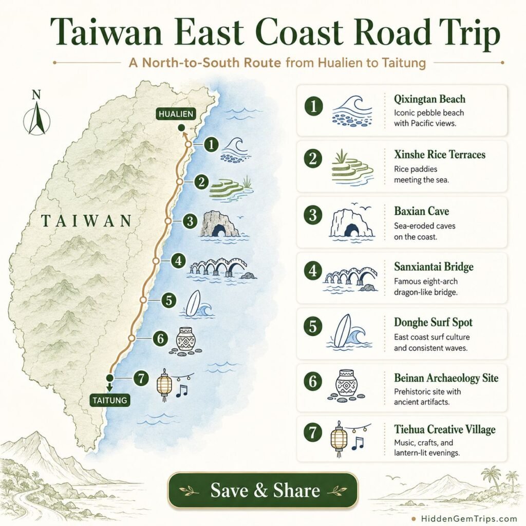
Taiwan East Coast: 7 Quiet Towns and Scenic Stops
The seven stops below run north to south. You do not need all seven for a good trip. Five is a comfortable first route; three can work for a short break; seven makes sense when you have enough nights to avoid driving every day from dawn to dusk.
1. Xincheng and Qixingtan Coastline
Xincheng is often treated as a transit point, but it works well as a low-pressure start. Qixingtan — also identified by Hualien Tourism as Malongayangay — is a curved pebble shoreline north of Hualien City with cycling paths and broad Pacific views. The official Qixingtan Beach page from Hualien Tourism describes it as a major local scenic area rather than a remote secret, which is exactly why it belongs here as an orientation stop rather than a “hidden beach” claim.
The coast is better for walking, sunrise, cycling, and photography than for assuming the water is safe. Eastern Taiwan can have strong wave action and steep shorelines. Follow signs and local safety guidance, and do not turn a dramatic sea into a swimming recommendation simply because the water looks calm from a distance.
Best use: arrive, walk, eat, and recover. If you have just come off an international flight or a late train, sleep in Hualien or Xincheng and start the long coast day with a rested brain instead of treating your first morning like a challenge.
2. Fengbin and Xinshe Terrace Paddies
Fengbin is where Highway 11 begins to feel distinctly rural. At Xinshe, sea-facing rice terraces sit between the Coastal Range and the Pacific. Hualien Tourism’s official Xinshe Terrace Paddies page explains the agricultural and Kavalan context of the terraces and provides current access information.
The responsible rule here is simple: use public paths and viewing areas, and do not step into working fields for photographs. The landscape is beautiful because people maintain it. A better visit includes a local meal or purchase, slower observation, and enough restraint to keep the farm functioning as a farm.
Fengbin is also a useful overnight strategy. Sleeping on the coast reduces the urge to cram Xinshe, Shitiping, Shimen, and Changbin into one long return drive from Hualien. Slow travel sometimes looks less romantic than expected: it can simply mean paying for one extra night so you do not spend half the trip inside a vehicle.
3. Shitiping and Shimen Recreation Area
Shitiping is one of the coast’s strongest geology stops. The official Shitiping attraction page describes marine benches, raised coral reefs, sea ditches, cliffs, and pothole landscapes created by erosion and uplift. These formations are visually striking, but the edge conditions are not decorative. Walk slowly, stay within clearly appropriate areas, and give rough water more distance than your camera lens suggests.
North of Shitiping, Shimen Recreation Area adds sea caves and reef ecology. The official page explicitly advises visitors not to venture into the attraction when weather and sea conditions are unfavorable and to watch footing in the reef area. That is more useful than any “secret cave” caption: the stop is worthwhile only when conditions support it.
For this kind of coastal day, a waterproof phone pouch can be practical for sudden rain and sea spray. It is a small convenience, not a reason to approach waves more closely.
4. Changbin and Baxian Cave
Changbin changes the tone of the route because Baxian Cave is both geological and archaeological. The Baxian Cave Visitor Center explains that archaeological work beginning in 1968 identified the Changbin Culture, with evidence extending back tens of thousands of years. The caves themselves were formed by marine erosion and later lifted above sea level by crustal movement.
That combination deserves more than a quick photo. Read the interpretation, use the visitor center, and stay on designated paths. The official visitor-center information also notes that some access involves climbing and that surfaces can be slippery in rain. Cultural and archaeological sites are places to observe, not to touch, collect, or improvise your own route.
If this “look beyond the headline attraction” approach fits your travel style, Hidden Gem Trips uses the same lens in Tanjung Puting beyond wildlife cruises, where the river and local systems matter as much as the famous wildlife.
5. Chenggong and Sanxiantai
Chenggong works best as a real town rather than a launch pad you abandon after breakfast. It has fishing activity, everyday restaurants, local services, and enough accommodation to make Sanxiantai easier to experience without a rushed day trip.
The official Sanxiantai page describes a 22-hectare coastal area with offshore geology, coral reefs, sea caves, sea columns, coastal plants, and an island trail that can take roughly two hours without rushing. It also advises visitors to check weather because terrain is rugged and reminds visitors not to collect plants or animals in the protected area.
Go early if you want more space, but do not make the eight-arch bridge the whole experience. The better rhythm is bridge, trail if conditions are suitable, water and shade, then lunch or harbor time in Chenggong. Staying locally can make that pace easier; you can compare flexible East Coast stays rather than returning to a distant base every night.
6. Donghe and Jinzun Surf Coast
Donghe shifts the route toward surf culture and looser roadside stops. Jinzun offers a coastal viewpoint, fishing-port scenery, and a long beach. The official Jinzun page notes that the Taiwan Open of Surfing is associated with the area and, importantly, that swimming is prohibited at Jinzun because of the beach’s steep slope.
If you surf, choose conditions that match your ability and use qualified local instruction when you are a beginner. The coast between Donghe and Changbin includes reef breaks and changing conditions; watching experienced surfers does not make a visitor ready for the same water.
A compact power bank is a practical road-day item if your phone is handling maps, translation, weather alerts, photography, and transport searches. The point of gear here is resilience, not shopping for its own sake.
7. Dulan and the Taitung Slow Base
Dulan is often described with shorthand words such as “creative,” “surf,” or “bohemian,” but those labels can flatten a village with Amis cultural presence, residents, businesses, homes, and a growing visitor economy. Treat Dulan as a place to spend time and money carefully rather than a set for lifestyle content.
Walk quietly through residential areas, park responsibly, ask before photographing people, and be conservative with drone use. A village can feel “chill” to visitors while residents are still dealing with traffic, noise, and privacy.
Taitung City is the practical southern reset: rail access, a wider range of stays and food, bike options, and a comfortable point from which to continue into the East Rift Valley. Ending the route with a rest day is not wasted time. It is how you finish with enough energy to remember the trip instead of merely surviving the final transfer.
For another town-based slow-travel comparison, see Colombia Coffee Towns: 7 Quiet Local Stops. The geography is different, but the planning principle is similar: fewer bases, more local time, less performance.
Optional Inland Pivot: East Rift Valley
If the Pacific route is too exposed, or if you want more train-friendly days, move inland through the East Rift Valley. Ruisui, Yuli, Fuli, Chishang, Guanshan, Luye, and Taitung can form a second travel rhythm built around rail stations, farms, hot springs, cycling, and broad agricultural landscapes. Use the East Rift Valley National Scenic Area for current destination information.
The coast and valley are not competitors. They solve different planning problems. The coast gives you geology and ocean scale; the valley gives you rail reliability and weather alternatives. A five-day trip can include one valley day. A seven-day trip can include two without becoming a full island circuit.
A Realistic 5-Day Taiwan East Coast Rhythm
| Day | Primary rhythm | Suggested route | Why it works |
| Day 1 | Soft arrival | Hualien / Xincheng + Qixingtan | Keeps the first day light and creates recovery time. |
| Day 2 | Rice terraces + coast | Hualien → Xinshe → Fengbin | Builds cultural and agricultural context before the big geology stops. |
| Day 3 | Geology + deep time | Shitiping → Shimen → Changbin / Baxian Cave | Pairs coastal formations with archaeology without rushing to Taitung. |
| Day 4 | Working town + landmark | Chenggong → Sanxiantai → Donghe / Dulan | Lets Sanxiantai breathe while keeping a real town in the itinerary. |
| Day 5 | Slow finish | Dulan → Taitung, or short valley pivot | Ends with rail access, rest, food, and a flexible departure. |
If you have seven days, add one valley day and one weather/buffer day. If you have only three, reduce the number of towns rather than compressing all seven. A route that leaves two good places unseen can still be a better trip than a route that turns seven good places into seven parking lots.
Responsible Travel Rules for Eastern Taiwan
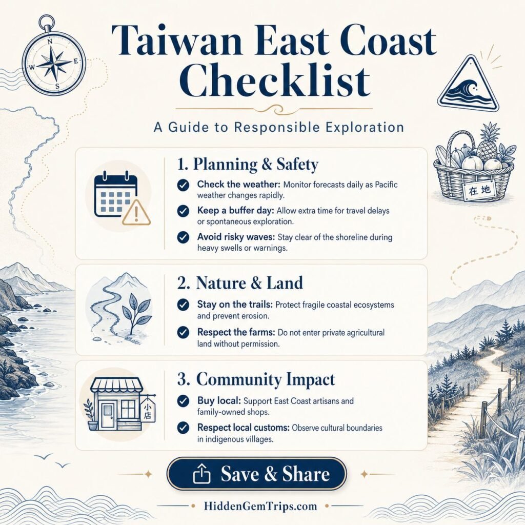
1. Check official conditions before exposed days. Use the Central Weather Administration, official transport pages, and attraction notices when weather, earthquakes, or roadwork may affect access. This article is not a live closure board.
2. Treat farmland and village streets as lived space. Rice terraces, fruit farms, harbors, temples, and residential lanes are not open-access content studios. Use public paths, ask before photographing people, and do not enter private land for a better angle.
3. Spend where you stop. Buy lunch, stay overnight when practical, use local services, and spread your route. Quieter places benefit more from patient spending than from a quick stream of visitors who only consume scenery.
4. Let weather cancel a plan. If the sea state is poor, skip the reef. If a trail is closed, it is closed. If a bus schedule changes, adjust the day. Flexibility is not a planning failure; on an exposed coastline, it is part of planning well.
5. Keep cultural shorthand under control. Avoid describing Indigenous villages as “untouched,” “primitive,” or “secret.” Those words make visitors sound adventurous by erasing the people who already know and live in the place. Research-led travel should add context, not mythology.
What to Pack for the Taiwan East Coast
Pack for humidity, sudden rain, wind, sun, and frequent transitions between trains, roads, viewpoints, and short walks. A small daypack is enough for most travelers who are not doing technical outdoor activities. Bring sun protection, a refillable bottle, a light layer for trains and evenings, and footwear that can handle wet pavement and uneven coastal surfaces.
A packable rain shell is useful when the forecast is mixed, while a lightweight daypack with a rain cover keeps the road day simple. The waterproof phone pouch and compact power bank already mentioned above are the kinds of small items that solve real travel friction without turning the guide into a product list.
Who This Route Is Best For
The Taiwan East Coast fits travelers who enjoy coastal scenery, rail travel, working towns, light hiking, photography, surf culture, agriculture, and a route with pauses. It is particularly good for travelers who want infrastructure without needing every day to revolve around a famous attraction.
It is less suitable for travelers who need guaranteed beach swimming, nightlife every evening, or a rigid schedule that cannot absorb weather changes. Families can do the route well by choosing fewer stops and using rail where possible. Older travelers may prefer more nights in Hualien, Chenggong, and Taitung rather than changing accommodation every day.
Final Thoughts
Taiwan’s east coast is not undiscovered, and calling it untouched would be inaccurate. It is better described as layered: highly accessible in some places, quiet in others, culturally specific, geologically active, and still shaped by agriculture, fishing, railways, tourism, and local life.
The seven stops work because each changes the pace of the journey. Xincheng gives you a soft arrival. Fengbin puts working landscapes in the frame. Shitiping and Shimen make geology tangible. Changbin adds deep time. Chenggong turns a famous landmark into a town-based stay. Donghe brings surf and road rhythm. Dulan and Taitung give the route a slower finish.
Go slower than the map suggests. Check conditions. Spend locally. Leave private spaces private. Use affiliate links only when they genuinely help with planning. And when the Pacific opens between the mountains and Highway 11, give yourself permission to stop without immediately turning the moment into another task.
FAQ
1. Is the Taiwan East Coast worth visiting without a car?
Yes. Use Taiwan Railways as the backbone for Hualien, the East Rift Valley, and Taitung, then add the Hualien East Coast Route 304, local buses, taxis, bikes, or guided day trips. Without a car, plan fewer coastal stops and stay longer in each base.
2. How many days should I spend on the Taiwan East Coast?
Five days is a comfortable first trip. Three days gives you a compressed sample; seven days makes it easier to combine Highway 11 with the East Rift Valley and still keep a weather buffer.
3. Which direction is better: Hualien to Taitung or Taitung to Hualien?
Both work. Hualien to Taitung gives a natural north-to-south progression and ends at a major rail base. The better direction is the one that fits your rail, flight, and accommodation logistics without forcing a tight final transfer.
4. Can I swim at the scenic beaches on the East Coast?
Do not assume a beautiful beach is suitable for swimming. Conditions vary by location and day. Jinzun, for example, officially prohibits swimming because of the steep beach slope. Follow local signs, lifeguard guidance, and official conditions.
5. Is the East Coast good for families?
Yes, if the route is simplified. Use rail when possible, choose one or two major stops per day, avoid exposed reef walks in poor weather, and stay in bases with reliable food and transport.
6. Do I need to complete Taiwan’s arrival card online?
If you are in a traveler category covered by the TWAC requirement, yes. The National Immigration Agency states that TWAC is free and should be completed online within three days before arrival and before immigration clearance. Check the official NIA page for current applicability.
Travel conditions, transport schedules, road status, weather warnings, attraction access, immigration rules, and opening hours can change. Always verify critical details with official Taiwan tourism, transport, immigration, and weather sources before travel. This guide is general editorial information, not legal, medical, safety, financial, or insurance advice. Some links are affiliate links and may earn Hidden Gem Trips a commission at no extra cost to readers. Affiliate relationships do not replace independent research or current official information.